West of Westwood – Three Counties Walk
- Paul Timlett

- Nov 23, 2025
- 13 min read
Updated: Dec 9, 2025

For the purists amongst you, you might want to look away as this walk spends much of its time outside of Wiltshire. But it starts and finishes in our county and for part of the time crosses countryside where the borders were frequently moved, such that places found themselves changing county over the years. But to help you make your decision whether to continue reading we will be visiting Somerset, and Bath and North East Somerset as well as Wiltshire in a landscape filled with beautiful historic buildings built of local stone.
My neighbour and regular walking partner Stu and I set out on a cold grey November morning under dark brooding skies. We’d been driving for no more than 15 minutes when it began to snow. We both love snow so our excitement grew. But it was not to last. No more than five minutes later it stopped and the grey skies returned. Our destination was Lower Westwood, south west of Bradford-on-Avon from where we planned to find our way to the River Frome where we planned to follow its course north west before crossing the river to follow the opposite bank back before leaving the river to return to the start.

We parked in front of Westwood Manor and St Mary’s Church in Lower Westwood where there is ample space for several cars. There is also a small parking area on the other side of the road for visitors to the Manor. At the time of our visit the house was closed for the season, not opening again until next Spring, so I assume the car park can be used for other purposes. Certainly we saw people park there whilst they walked their dogs in the neighbouring fields. I would have liked to have seen the gardens of the National Trust's Westwood Manor as this 15th century building is famed for its topiary. I did get a glimpse of this at the end of the day when we returned to the car as someone had left the side gate open but the best of the topiary was behind closed doors.

Disappointed not have been able to visit the Manor we spent some time in the fascinating Church of St Mary the Virgin next door. In terms of Medieval churches it’s not that old, dating from the 15thcentury. I assume it was built at the same time as Westwood Manor, although the Manor belonged to the Priory of St Swithun at Winchester. Inside the church we found a couple of memorials to members of the Peto family who were to feature later in the walk.

What fascinated me though were the stained glass windows in the chancel which are believed to originate from the 15th century. The windows are made up of fragments of glass so it is assumed they were initially located elsewhere in the church.

On leaving we almost missed The Devil of Limpley Stoke glowering down at us from above our heads. I’ll leave you to read the notice describing its origins, but when leaving the church it’s worth looking up at the hunky punks outside on top of the tower at the western end of the church.

And before leaving the churchyard take a look at the carvings above the small door into the Chancel at the south eastern end of the church where you will find a couple of apotropaic daisy wheels (hexafoils) to trap evil spirits, as well as other curious carvings.

On leaving the church we crossed the road and entered the field opposite over a stile. We were to follow the footpath across several fields in a southerly direction all the way to the A366. At the second field the right of way goes straight ahead across a field which had been ploughed and a crop sown. There were two tram lines across the field enabling passage without damaging the crop but we chose to follow the field boundary to the right to be sure of causing no damage. On reaching the next field the farmer had left a very clear path through the crop. I wish more farmers would follow this one’s example.
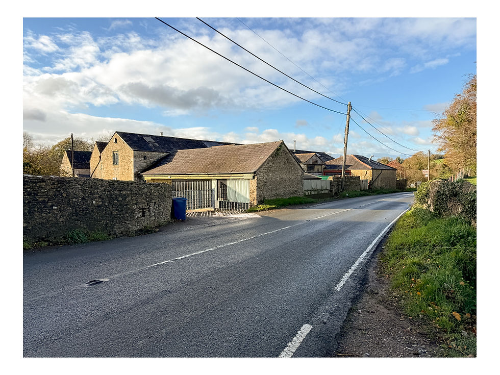
Eventually we came to some farm buildings on the north side of the main road, one of which was used by Stowford Education Centre. A gaggle of young children was being shepherded in by the staff. We needed to cross the road to the main Stowford Farm buildings on the other side. This involved walking to the right along the road for about 50 metres. This was pretty hazardous. It’s a busy road and the traffic made no attempt to slow down despite the presence of children and two old blokes trying to cross. There is a blind bend to the left which made it even more treacherous so I would recommend getting over as quickly as possible when it’s safe to do so. In the photograph below the entrance we used is beyond the last building.

Stowford Farm is also a campsite and a number of outbuildings are let out to various small craft businesses. Our next objective was to be Farleigh Hungerford en route to which we would cross into Somerset, the border of which runs along the River Frome. This involved following the course of the river along its north bank. There is no public right of way along the river bank but there is a permissive path and it took us some time to find it. We wandered around the farm buildings trying to find someone who knew where the permissive path began. The campsite reception was closed and the many people around the farm took no notice of us whatsoever. We eventually found a notice about the permissive path partially hidden in the hedge by the road just by the area used for trotting ponies where you drive into the car park. There were a couple of gates after this point heading west barring the way along the riverbank. We assumed they were locked as the campsite was closed but no one took any notice as we climbed over them!
Update on this route: When I posted this walk on the Hidden Wiltshire Facebook page someone commented that they knew this permissive path very well. It seems that the aforementioned gates are only open when the campsite is open so I guess they are closed the rest of the year. However the permissive path sign below does not say it can only be used when the site is open so I assume climbing the gates is accepted as they are there to prevent vehicles entering the camping field. Further west along the road towards Farleigh Hungerford is another gate into the field giving access to the permissive path and it looks like this is always open. But this does mean walking further along the busy road which I would not be keen to do.

If you follow the route shown on the map accompanying this walk description you will be on the line of the permissive path. Eventually we came to an open gate leading to a field owned by the Farleigh & District Swimming Club, the oldest swimming club in the world founded in 1933.

The location was idyllic and the facilities perfect to enjoy a swim in the river. But not on a freezing November morning! So we contented ourselves with a coffee and wee nip of whisky sitting in the club’s open sided wooden shed above the field.

From the club’s field we walked to the stone road bridge in the corner of the next field. Here there was a stile enabling us to reach the road through Farleigh Hungerford. The bridge looks older than its 18thcentury construction but is thought to have been based on a Medieval structure.

We crossed this bridge over the main course of the Frome and then another bridge over the smaller channel of the river. We then continued along the pavement to the top of the hill opposite the castle of Farleigh Hungerford where we crossed (with care) to the castle.
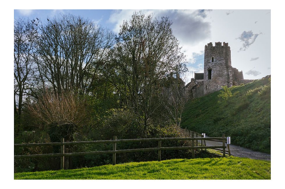
The castle is owned by English Heritage and was closed on the day of our walk, but there were staff present as there was a school visit so we were able to walk into the grounds by the reception office. The castle was built around 1370 and was the former home of Sir Thomas Hungerford, Speaker of the House of Commons. In the early 15th century his son, Sir Walter Hungerford, enlarged the castle by adding the outer court that enclosed the parish church, St Leonard's, which he used as his chapel. It is thought that he built the present parish church nearby to replace it. In the Civil War, Sir Edward Hungerford briefly commanded the Parliamentary forces of Wiltshire. His half-brother, Col John Hungerford, was a Royalist and was given the command of the garrison of Farleigh in 1644. However he surrendered to Sir Edward without a fight in 1645. By the 18th century, the castle was no longer lived in by its owners and fell into disrepair. In 1730 it was bought by the Houlton family, Trowbridge clothiers, when much of it was broken up for salvage.

If you were to do this walk in the summer when the days are longer you could easily spend an hour exploring the castle. We were relieved it was closed as we were already concerned about finishing the walk in daylight. By the entrance to the castle there is a finger post pointing out two footpaths. Ours was the path to the right that descends some steep steps to the narrow valley below.

It was a simple matter of following the footpath from here, which was now the Macmillan Way, north along the River Frome towards Iford Mill. But first, on leaving Farleigh Hungerford, the magnificent Rowley Grange came into view across the valley, picked out by the shafts of sunlight emerging from the clearing clouds. Historic England describes it as a 17th century barn, now a country house converted to its present use in 1920. It must have been one hell of a barn!

We followed the river for around a kilometre passing another substantial country house, the curiously named Dogkennel Farm and then Dogkennel Farm Cottages, where we crossed into our third county – Bath and North East Somerset. Emerging onto a narrow lane by the cottages we could see Iford Manor along the lane to the right.

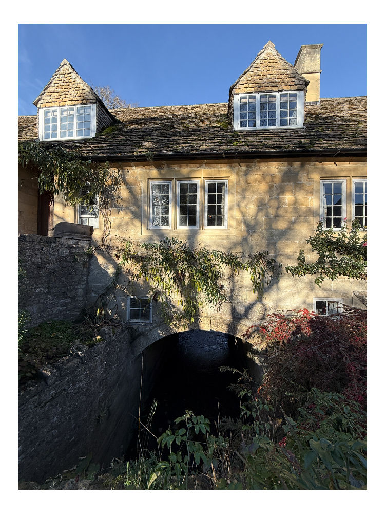
We planned to visit this on the return journey but we wanted to see the 17thcentury Iford Mill which was on our side of the river so we walked the short stretch of lane to the Mill.

However we could not resist the temptation to continue the short distance to the 14th century bridge in front of the Manor. The Manor was bathed in sunlight, so I took a photograph of it with the statue of Britannia in the foreground in case the clouds returned later. The statue was added by Harold Peto in 1899 (remember the memorials I mentioned in Westwood church)? It once bore a trident in its right hand but this is now gone. (See photo at top of page.)

We returned to the point at which we had emerged from the water meadows by Dogkennel Farm Cottages and entered the next meadow across the lane to follow the public footpath north-west towards Dunkirk Mill. Shortly we saw a chap out jogging along the path towards us. He stopped to say hello and asked what we were doing as he had noticed the camera slung round my neck. I recognised this chap but on this occasion had no trouble remembering his name, as I normally would, as it was written on his reflective vest along with his blood group. I had the upper hand as he didn’t recognise me. I remined him that we had ridden together in the same cycling club, Westbury Wheelers, many years ago. Inevitably for three blokes of a certain age the conversation soon turned to bladders and prostates. We spent a very splendid 10 minutes comparing symptoms before parting ways. James was skimpily clad in lycra running gear and needed to keep warm. Stu and I on the other hand were layered up in thermal underwear, fleeces and down jackets so we could have chatted all day.
The line of the public footpath soon climbed upwards into the edge of a wood on the left, Friary Wood. This was the only part of the walk where we saw other walkers. After a short stretch through the woods we emerged into open countryside again arriving at Friary itself. Now just a hamlet this was once the location of what is called a correrie, one of only two or three in England. A correrie is a lower house to a priory, in this case Hinton Priory whose remains are on the other side of the hill to the west. Hinton Abbey and Priory was a Carthusian order founded in the early 13th century whose monks lived a solitary life as hermits. Since they confined themselves to cells in the abbey their daily needs were tended to by lay brothers who occupied the lower house (the correrie) literally at the bottom of the hill by the river.

Nothing remains of the friary but earthworks. Here we found an old wooden handcart on which were a few jars of honey for sale, the timeless feel shattered by the presence of a chalk board on which were details to enable you to make a bank transfer for your purchase.

Next to this was a bench on which we’d hoped to sit whilst we had our lunch but it was already occupied by two similarly aged old chaps having their lunch. Next to them was the information board in the photograph.

We found another bench up the hill on which to rest. This gave us a commanding view of the valley in which the sinking sun had picked out details on the opposite bank.

The air was chill so we finished our lunch and continued up the valley the short distance to Dunkirk Mill. At the head of the valley was a huge building swathed in scaffolding. To the right was an Archimedes screw winding water to another channel above the weir. There is a substantial amount of building work, including flood alleviation, going on here but I’ve no idea what the huge building is. It is not listed so does not appear on the Historic England website. It looks like a mill but it is not Dunkirk Mill which was now in front of us on the path. Dunkirk Mill and Middle House is a rather plain looking building, now two houses, and was built as a cloth mill in 1795. Following the lane to the right we passed the more attractive Dunkirk Mill Cottage also built in 1795 for the clothier Thomas Joyce.

The lane passed behind the building site and followed a stream the other side of which was a pill box, presumably part of the Stop Line. The lane curved round to the right and behind us high above we could see the 14th century house called The Hermitage in Sharpstone.

The lane then climbed and at the entrance to the building site there was a footpath into a field. Here we followed the fence line on our right and the path led down to the top of the weir where we followed the path along the banks of the river below some trees before emerging into wide meadows, now on the opposite side of the Frome along which we had been walking all day. We followed the public footpath through the meadows until it climbed gently to Iford Lane which was to lead us back to Iford Manor.

Iford Manor and its gardens is a place of great beauty. It was first built some time in the late 1600s. It was extended by the architect Harold Ainswoth Peto for himself and his family in the late 19th/early 20th century and he is commemorated by a plaque in Westwood Church. The Manor is now a café and bakery/restaurant with accomodation. Luckily for us it was closed when we walked past otherwise we’d probably still be there.

There are several kilometres of footpaths through the wider area owned by the Manor, although the formal gardens are closed until next spring (open April to October). According to Iford Manor’s website otters and beavers can be seen along this stretch of the river.


After taking a few photographs we continued along the lane past the manor house and between high stone walls, the lane climbing steadily.

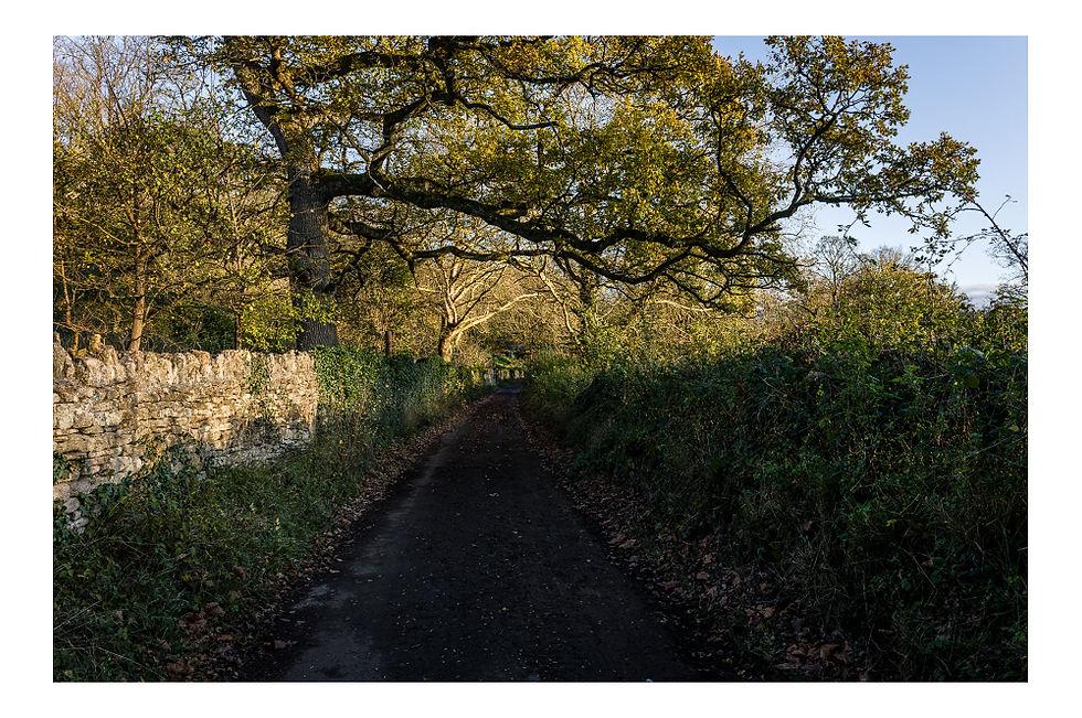
The lane then turns sharp left and climbs dramatically but we continued straight ahead onto a bridleway through the woods. We followed the bridleway, still climbing gently, for about a kilometre. Being a bridleway it had been churned up by horses and bikes and was very muddy in places.

Eventually we emerged onto the country lane where we would turn left back towards Lower Westwood. But first we had more to see – the site of the Medieval village of Rowley, also once known as Wittenham. The village exists now only as a series of earthworks on either side of the lane. In the low afternoon sun the layout of the main street and enclosures was clear.
The lost village of Wittenham, once a separate parish, is first mentioned in AD1001. It appears in Domesday Book as Withenham. From 1300 onwards it is referred to as, or with, Rowley as a manor or village, and in 1428 was amalgamated with Farleigh Hungerford.
The field to the west of the lane contains a number of enclosures with an apparent platform. On the east side of the road there is a prominent holloway running due east. To the south east of this are several platforms behind which is a headland with a ridge and furrow running east. To the north of the holloway is a sunken area, bounded by two headlands.
The fields have been left as pasture so have not been ploughed. I climbed the gate into the field to the east of the lane whilst Stu remained on the road. I walked through the village in the gloaming imagining the sights, sounds and smells of a millennium ago. As I reached the top of the meadow the recently repainted Westbury White Horse shone like a beacon in the distance. I recorded this short video at the site.
Returning to the road we had two route options. On the map below I have traced the route of the public footpath along the field boundary. As we had finally managed to remove the mud from our boots we decided to follow the road back to Lower Westwood. But if you do this be warned – it is a narrow single track lane and we had to make way for several cars since it was now nearly 5:00pm and people were coming home from work. Entering the village the church came into a view as we passed a small cottage, briefly lit by the vestiges of the late afternoon sun. We then passed the magnificent Old Vicarage before rounding the bend to the church and the car.


This had turned out to be a wonderful day in beautiful countryside. I have to admit early on, when we couldn’t find the permissive path at Stowford Farm, we thought we would have to abandon the walk. Walking along the busy and fast A366 to Farleigh Hungerford was simply not a safe option. But we were glad we persisted and found the permissive path, and if you follow the route map you will be fine. In all the walk measures just over 10 kms/6.3 miles. It was easy going but will be muddy after rain.

For those who use the OS Maps app here is a link to the route map


Comments