
Cowper's Cross, Tragic Washern and Netherhampton
- Elaine Perkins

- Nov 16, 2025
- 8 min read
This is a wonderful and diverse walk with lots of interest and varied history across the ages. It is one I have been planning for a while, but on reading the book, recommended to me by a follower of Hidden Wiltshire, called Arcadia: The Dream of Perfection in Renaissance England, by Adam Nicolson. I learnt a little more about the area to add more interest and poignancy to the walk. I also thought that if we timed things correctly for lunch, I remembered that there was a lovely thatched pub in Netherhampton that had been somewhere I had wanted to visit for a long time, as it looked so cosy. Well, the timing for that wasn’t right for a number of reasons, as you will learn later.

We started our walk in Harnham, but if you are travelling by car, you may find it easier to park on the Old Shaftesbury Drove at Hare Warren and start the walk from there.
For our walk, we made our way onto the Cranborne Droves Way, and taking this route, we skirted around the Harnham Chalk Pit before emerging from the trees onto open fields, or at least they would have been open fields but for the fencing that is currently in place guiding the walker away from the area where new buildings are being erected. All at once I was disappointed (and not for the only time on this walk) that I had not come on this walk earlier, but then I suspect my disappointment would have been worsened by the memory of the view that I had probably lost. Although, even with the new housing development, the view across the river valley to the hills was still glorious with the early morning sun glinting on the autumn colours of the trees.

Continuing on the fenced way, the walk seemingly foreshadowed one of our future destinations. From the fences we were offered partial views of the landscape, a lone tree in the hedgerow, Wilton and Grovely Woods and indeed Salisbury Cathedral’s spire that was, for once, seemingly diminished by the hillside and electric pylons.


As we climbed, we eventually got away from the fencing, trading it in for a treelined footpath. One of the trees was a crab apple, and once again we were reminded of the incredible year it has been for fruit and nuts, as the path floor was completely covered in tiny apples that had dropped from the tree, forming a short yellow and red carpet before us. We picked our way carefully through the apples so as not to tread on too many, and I wondered if the old saying that heavily laden fruit trees were a predictor of a harsh winter would be true this year. However, so far, the reverse has been true for autumn.

Just a bit farther along we reached the Old Shaftesbury Drove and turned right. Here both drove ways run together for a short distance, and I mused on folk of the past exchanging stories of the different routes and how far they had come. We, on the other hand, were walking along by ourselves with perhaps only a dog walker sighted in the distance.
Soon we came to some more fencing. This time it was the white railings of Salisbury Racecourse. Again, I wondered why I hadn’t walked along this route before, with its views of the racecourse, Salisbury Cathedral and Wilton House. As we walked, the grandstand came into view, and I thought back to the Northamptonshire village I grew up in. Where Salisbury Racecourse has thrived, the one in Northamptonshire did not. Its grandstand was already a ruin in my childhood, with stories of the ghostly sounds of pounding hooves and cries of the crowd being heard at night. I knew to steer clear of the place, and racecourses have felt eerie to me ever since, plus I have always felt concern for the horses. Yet, now I wondered what it would be like to be stood by the railings on an actual race day and sense the power of the passing thoroughbreds and the excitement of the crowd.

As we continued, we crossed Ackling Dyke, the Roman road that runs from Old Sarum to Badbury Rings, and here we parted company with the Cranborne Droves Way as it continued south, for the most part following the course of the Roman road until it joins the Ox Drove south of Stoke Farthing. Just a little farther along the Shaftesbury Drove we noticed a wider path to the right that ran right across the racecourse. I took the opportunity to stand on the path and take a photograph of the course towards where most of the crowd sit or stand. It was so like the fence lined path we had just walked.

On returning to the walk, I noticed a pristine Wiltshire Council byway fingerpost, and underneath MadK had written, no doubt purposefully, a biblical misquote stating that “Poverty is the Root of All Evil.” To be honest I feel that the actual quote that “The love of money is the root of all kinds of evil” is truer and more relevant today than ever before, but no doubt the opinion on this is divided. Perhaps it is inequality that is the problem. I personally cannot think of a starker contrast between someone who relies on the charity of food banks, etc., to live and someone who has sufficient funds to gamble on a horse race. These thoughts were now weighing heavily on my mind as we were heading towards an area where such inequalities were laid bare many years ago, but we hadn’t arrived there just yet, although we were about to enter the Arcadia spoken about in the book.

But first, we were in search of Cowper’s Cross. All that remains of the cross is the base, but it is said that this cross, marking the crest of the hill, was used as a landmark for the original horse races from Wilton House and no doubt the origin of the Salisbury Racecourse. Sadly, I have not been able to glean any more information about the cross, other than Cowper is likely a name and there seems to be a more famous Cowper’s Cross on Ilkley Moor.
Having found the cross, we then continued on and headed over a road before turning right onto a footpath leading briefly through Hare Warren, which is woodland currently leased to Forestry England. The woodland looked splendid in the autumn sunlight and made a nice variation to the walk.
Hare Warren is so named because it was kept as a specific area for hunting hares. It contains a number of historically significant areas, such as the Bronze Age bowl barrow known as Neale’s Barrow and a WWII Super Zero bunker. However, on reading the Forestry England page about the woods, it suggests you can only walk on the designated footpaths, so I do not know if it is possible to visit either of those sites. We continued on the footpath through the woodland and out once again into open fields.

Here now, just to the right of the footpath, you can more or less make out the line of the wall that surrounds Wilton House. Just a little beyond the wall there was once a village called Washern. The only nod to its existence now is the stable complex known as Washern Grange. The sad story is that, although the villagers were allowed to stay when they were existing on Abbey property, the same was not true for the new owners of the abbey grounds after the dissolution of the monasteries. Washern was not wanted as part of the Pembroke Arcadia. At first the villagers were given incentives to move. Although these did not really compensate the villagers, they did move away as their new landlord required, and the Pembrokes embarked on producing their parkland. However, what happened next was terrible. The country was in a poor state, and it appeared that the king, now Edward VI (or at least his protector) was in favour of those with a rightful claim taking back parkland from the lords who ousted them. Also it seemed that the words of the Bible were on the villagers' side too. So, they returned to Washern believing right was on their side. However, it wasn’t, and sadly they paid with their lives. I return to the idea of the root of all evil and ask if it was poverty or the love of money that caused this tragedy. Or perhaps the two are too intimately entwined?
Back to the walk, we continued on Warren Down, past a wonderful yew tree and then through a wooded area of magnificent beech trees, their fallen leaves producing a gorgeous orange carpet.

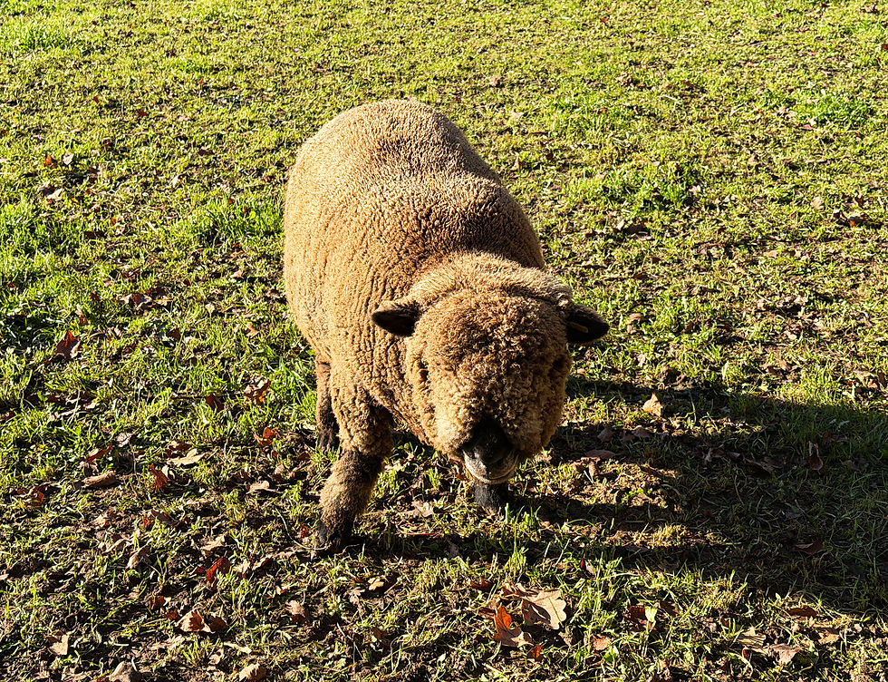
We then crossed over two fields before meeting a bridleway that skirts the Wilton House wall and leads on past the Wilton Hunt kennels before it joins the road, that we had previously crossed, just before Netherhampton. As we walked, we put Washern from our minds and instead enjoyed talking to the animals that we saw along the way. The hunt that is here, was not out in the field where we sometimes see them. Perhaps they were in their kennels.
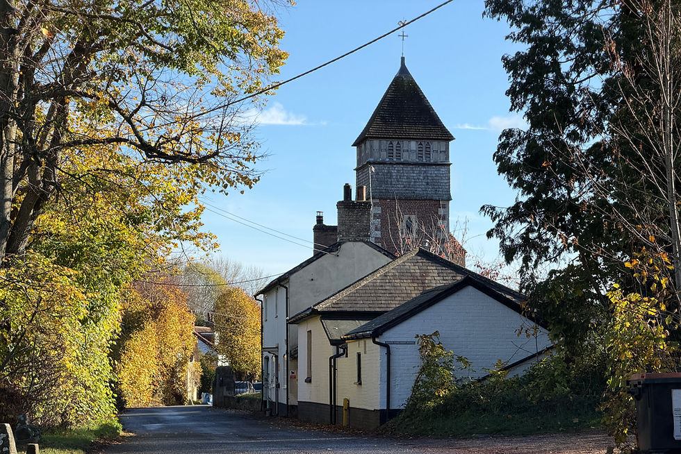
We continued on our way along the road and into Netherhampton. Here we found a lovely village with an interesting church sporting a wonderful tower with a tiled roof. The churchyard also contained the remnants of a stone cross. This seemed to be in a slightly more preserved state than Cowper’s Cross, but I was still not able to find any more information about these crosses.

We had arrived in Netherhampton too early for the pub to be open. However, we found out that, in reality, we were too late, as the pub is now permanently closed and there is a planning application for it to be turned into a private dwelling. Feeling dissapointed for the second time and sad that the pub was shut, we felt sure that the church would be open, but again we were disappointed. So there was nothing for it but to move on through the village, stopping here and there to marvel at the wonderful buildings, especially the ornately fronted Netherhampton House. This house was built in the 17th century by the Pembrokes and is definitely one of the most magnificent buildings I have seen in a village.

It didn’t take long to reach the end of the settlement, and we walked along the main road a little way before turning left onto part of the Roman road we had crossed over earlier. The OS map suggests another stone cross, St Anthony’s Cross, is located at this crossroads of the Roman road and the A3094. This particular cross was thought to have once acted as a plague stone. However, it is believed that nothing remains of it today.
Now that we were back in open fields, I contemplated the magnificent Salisbury Hoard. This hoard is the largest group of prehistoric metal objects ever found in Britain, and it was uncovered here. I believe all that remains of the hoard are now kept in the British Museum. It is amazing to think of the tremendous history of this place and more still being uncovered during the recent house building.
Continuing on our walk, we soon turned off the Roman road and headed along a diagonal path over water meadows towards the River Nadder and the new Broken Bridges Nature Reserve. This is a lovely area to walk, and it is a triumph that the trustees have managed to secure this site for the people and wildlife of Salisbury.

On exiting the reserve we turned right onto the Cranborne Drove’s Way and back to the starting point.
The walk is approximately 7 miles long but fairly easy to walk with good paths, although they might become very muddy in winter. I know that this blog has only scraped the surface of the history and interest of the place. I definitely recommend it.

Links associated with this walk that might be of interest to you:-
For the latest findings at Netherhampton: https://cotswoldarchaeology.co.uk/netherhampton-road-salisbury/
For some information on the Netherhampton Hoard: https://archaeology.co.uk/articles/reviews/museum/review-hoards-a-hidden-history-of-ancient-britain.htm
For the plague stone https://salisburymuseum.wordpress.com/2018/12/04/the-netherhampton-plague-stone-by-volunteer-alan-crooks/
For more information on Broken Bridges https://mybrokenbridges.org.uk


Sorry. Elaine, not Paul!
A great writeup of what looks like a lovely walk, Paul. Despite growing up in Wilton with a family who were keen walkers I have never set foot on any of this, aside from the Shaftesbury Drove.
It's a shame to hear of the demise of the V & A - I spent many a happy Saturday afternoon in its beer garden in the 1970s. It was a favourite watering hole of my parents and their friends.