
Searching for Kitt’s Grave (In Memory of Kay Chalk 1929-2019)
- Paul Timlett

- Aug 27, 2020
- 11 min read
Updated: Aug 10, 2025
This walk scrapes into Wiltshire by the skin of its teeth. In fact I parked my car in Hampshire but within 100 metres managed to escape back to Wiltshire. The walk takes in some truly spectacular scenery mixed with a little history and a smattering of mystery. I thoroughly enjoyed every 59.9 seconds of this walk. But what, I hear you ask, of the remaining 0.1 second? Well, let’s get this out of the way. It’s time for a rant.
Why is that people come to some of the most beautiful places and decide to trash them? Why go to the trouble of driving all the way to out of the way places only to scatter litter and leave piles of dog poo? Surely they must look with disgust at what other people have left behind, only to then add their contribution? Or maybe they don’t notice these things? They clearly give no thought to those that follow. It’s not a huge difference to fly tipping. As the Australian Prime Minister Scott Morrison said about panic buying “STOP IT. JUST STOP IT”!
Anyway, I’m glad I’ve got that off my chest. Back to the matter in hand.
This 14.5 km/9 mile walk across easy terrain begins at the Martin Down Nature Reserve free car park by the A354, passes through Vernditch Chase, over Marleycombe Hill, along the Chalke Valley before returning up Church Bottom to briefly touch Ox Drove and the final leg on a Roman road. The start and end of the walk tracks the county border so if we ignore the car park this definitely qualifies as Wiltshire.
Having parked the car it was necessary to cross to the north side of the A354. This can be a precarious process. Traffic always travels quickly along this road, and at the wrong time it can be busy. I set off at 9:15 on a weekday so the rush hour had passed. But extreme caution was still required to cross safely to the track opposite the car park entrance.

Once safely across the road the track quickly led into the Forestry Commission woodland of Vernditch Chase. This is a 230ha/568 acre area of mixed woodland managed by the Woodland Trust. You very quickly get a sense of the history of this place just before you enter the wood. On my left next to the bridleway was a hump which I first thought was a long barrow. It is in fact the bank, or agger, on top of which ran Ackling Dyke Roman Road. The road runs for 22 miles from Old Sarum to the hill fort at Badbury Rings, providing a rapid transit route for Roman soldiers. It formed part of a wider network or roads. From Badbury Rings the network heads south to the harbour at Hamworthy, and west through Dorchester onwards to Exeter. To the east from Old Sarum it connected to the Port Way to Silchester and London. The top of the embankment now forms the border with Hampshire/Dorset.


Once into the woodland I quickly came across a long barrow in a small clearing to my right. As you pass this barrow you enter deep into the twisted chaos of woodland following a clearly defined path. Even at this early hour the heat was fierce on this end of July day so the shade provided by the dense cover of a trees was a welcome relief.
Route finding through this part of the wood was pretty straight forward. Emerging briefly from the tree cover into an open glade I bear right towards a rather pointless metal pedestrian gate standing alone in the glade. On passing the gate (you can go through it if you like!) I entered the woodland once again. After about 75 metres I followed the bridleway round to the left ignoring the wooden gate to the right with its information board. A couple of days after I completed this walk someone told me that the large edible Roman snail can be found on Vernditch Chase. It’s a protected species and the largest in the UK. I did not see any. And they weren’t the only thing I didn’t see as you’re about to find out.
This brings me to the title of this walk. The 1:25,000 OS map has the words ‘Kitt’s Grave” to the west of the wood. Intrigued by this I headed to the end of the bridleway to the point where it leaves the wood and a track joins from the right, before heading north west through a tunnel of trees between open fields of crop. I ventured onto the edge of the field of crops to my left. I wasn’t really sure what I was looking for but could see nothing that looked like a grave. So I went into the field to the right. At the corner of the field formed by the two aforementioned tracks there were several clumps of tall grass. Thinking each one might conceal a grave I poked around but to no avail. This was starting to get personal. I Googled Kitt’s Grave to find out more. The sensible thing to do would have been to do this before I set off. Various stories abound as to who Kitt was. Some say Kit(t) was a highwayman. Others that Kit(t) was an old gypsy woman found dead hereabouts. However, someone who claimed to have found Kitt’s Grave identified it as a long barrow in the beech wood that lay to the right of the bridleway I had been following before reaching the edge of the wood, and indeed the map shows a long barrow in the wood. I plunged into the trees and started to hunt around, getting further and further into the woodland. After spending far too long searching, I gave up. Notwithstanding the folklore, it seems Kitt’s Grave is in fact a very indistinct long barrow, so likely Neolithic or Bronze Age. Being (how I read someone else describe themselves) a completist this really irked me. I’m a stubborn persistent bugger and this was unfinished business. Hold that thought!

I continued on my way back along the bridleway through the tunnel of trees between the fields, north west in the direction of Marleycombe Hill. On reaching a minor road I turned right along it for a short distance reaching a yellow grit bin at the junction of the road and Ox Drove. There was a small copse to the right which seemed to be a favourite spot for fly tipping. Passing the sodden mattress (which will hopefully be gone by the time you visit) I climbed the stile next to the metal gate on my left onto the footpath over Marleycombe Hill towards Bowerchalke. The views that open up to the left and behind as the path climbed gently were spectacular. It was now 11:00 and it had taken me nearly two hours to make not very much progress at all, due to my blundering around in search of long barrows. It was getting near to coffee time.
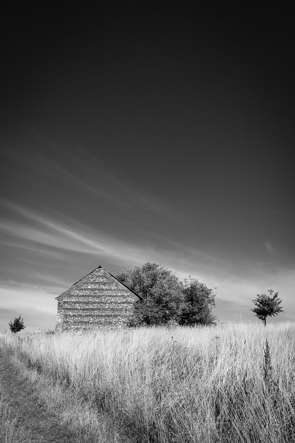
Passing the magnificent lonely and photogenic flint barn by the path I descended towards a style where I was greeted by yet more stunning views. The perfect spot to take a panorama since there was no way I was going to get all that countryside in one frame. I then turned to the right away from the path heading to the clearly defined earthworks on the hillside. The perfect place for coffee and to watch the cricket match taking place on the immaculate pitch in Bowerchalke far below.


I was going to say I wasted yet more time sitting on Marleycombe Hill but that’s not true. It wasn’t wasted time. After all, enjoying the peace and solitude is what it’s all about for me. I could easily have spent hours here, surrounded by red clover and betony, nodding off in the morning sunshine to the soporific sound of the buzzards circling overhead. However there was a walk to be completed. There were two route options here. Backtrack to the footpath and descend into Bowerchalke in order to head north east along the road through the village, or continue along the escarpment of the hill. Being a miserable old sod I took the latter course. I had no wish to hasten my encounter with “civilisation”. So I continued across the northern face of the hill and then zigzagged on the faint path downhill to pick up another footpath into Mead End, at the eastern end of Bowerchalke. This was a wide grassy path and it’s worth looking back at this point to the brooding bulk of Marleycombe Hill as it watches over the village.

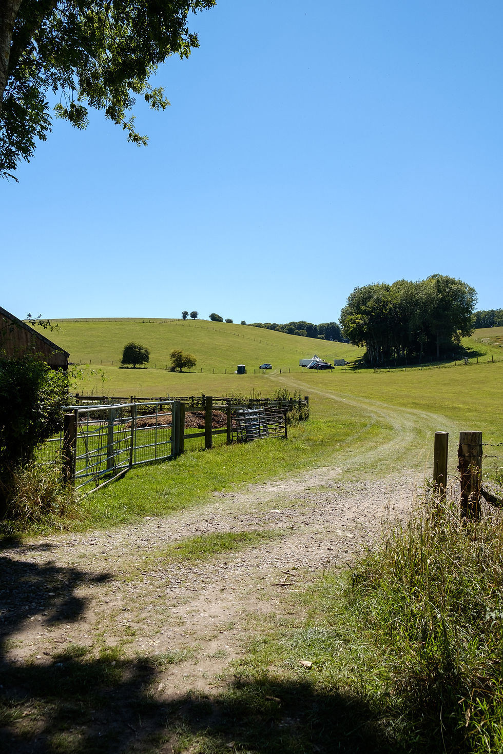
At the end of the path I turned right opposite Hayes Barton onto the stone track that led to Church Street. Turning right onto Church Street after 200 metres I came to the entrance to Bowerchalke Barn and Knowle Farm. Although not marked by any signs a bridleway leads straight ahead through the farmyard at the end before bending left between substantial farm buildings. However a better option is to take the permissive path on the left after the flint and brick building on the corner of Church Street and the farm entrance (see photo).

Follow the drive to pass in front of a beautiful thatched barn before going through a gate on the right into a small paddock to the gate opposite to meet the road/bridleway emerging from the farmyard. Got that?


From this point it was a simple question of following the farm road for a couple of kilometres towards Broad Chalke, not forgetting to take in the views all around.

Ignoring the bridleway that forms a crossroads with our route at the top of the hill (and which heads right, up to Knowle Hill) I continued straight ahead towards and past Field Barn and its storage containers. The next waypoint was the fork where a grassy path head away to the left, leaving me to continue on the stone bridleway ahead. The bridleway becomes grassy and narrows before ending opposite a thatched wall on the outskirts of Broad Chalke. Turning right to follow the stone track I eventually reached the narrow road that descends left towards the village. After 200 metres I came to a turning on the left signposted Bowerchalke and Shaftesbury. I turned onto the bridleway opposite and to the right that ascends Church Bottom, making sure to ignore the footpath to the left shortly after the house called Church Bottom.
With the utmost politeness I have to confess a fondness for Bottoms. And Church Bottom is as fine as any you will find anywhere. As I ambled along the bridleway, off to my right I could see a handful of scout tents and cars in the field where a barbecue appeared to be in full swing. I think this is the site of the Chalke Valley History Festival which was sadly cancelled in 2020 due to the pandemic. I assumed this was a small informal gathering of diehard historians. And what a time to do it, on a hot summer’s day under clear blue skies.

Soon I was to come to what would become the inspiration for the second part of the title of this blog. A perfectly placed simple wooden bench erected in memory of Kay Chalk. I don’t know who Kay was but she must have enjoyed this spot during her long life. She died at the age of 90 in 2019 and I can’t think of a better place for her spirit to remain. I sat here for some time, finishing my coffee and thinking of my own mum who was just a year younger than Kay, although sadly she did not live nearly as long. Just like Kay, she would have been a great grandmother now. Eventually I went on my way, saying my goodbyes to Kay and thanking her for her hospitality.

A little further along the bridleway there was another choice of routes. Initially I had planned to continue along Church Bottom to Ox Drove at the top of the hill. However, I was delighted to find a gate on my right into Middleton Down Nature Reserve. By sticking to the valley bottom the path through the reserve initially runs parallel to the bridleway before climbing away to the right. There were signs warning that a bull was in the field. I was feeling pretty smug having not encountered him until I rounded the bend in the path to see a herd of cows and their calves together with a very handsome looking black bull. I gave them a wide berth by climbing the hill to the fence line on my left. The herd barely gave me a second glance. Following the fence line I came to the south west corner of the reserve where the right of way continues through a pedestrian gate and on to join Ox Drove.

Turning left onto Ox Drove I soon came to a bridleway on the right that ran along the left hand edge of a huge field of arable before turning right to continue along its bottom edge adjacent to Knighton Wood. After a short while a clearing appeared in the wood named Moody’s Gore on the 1:25,000 OS map. Here there was a yurt and a paddock occupied by horses. I had planned to turn left here to follow the footpath marked on the map along the south west edge of Knighton Wood down to Ackling Dyke, but the paddock had been fenced off and there was no visible sign for the footpath. Perhaps the path was along the edge of the adjacent field but I still did not see a sign so I continued along the bridleway.

Eventually the bridleway reaches the minor road from the A354 to Broad Chalke which I had come across an hour or so earlier in the village. Crossing the road into the Vernditch Down/Gardiner Wood car park I made a serious mistake. I had intended to pick up the Ackling Dyke at this point and follow it back to the start at the Martin Down car park. Until now I had been checking my route on the OS Maps phone app. As I walk I also make notes and take photographs on my phone to act as a memory jogger for the preparation of these blogs. I had been eking out the final few percent of battery when it finally died just as route finding became critical. A quick look at my paper map and I went past the barrier ahead onto the broad forest trail into the woods. I passed two people walking their dogs (and since they were not carrying dog poo bags I had a serious mutter to myself) and assumed I was now on the Ackling Dyke. As I continued through the woods I started to question my route choice. This was the windiest Roman road I had ever been on. Was the surveyor drunk when he plotted the route 2,000 years ago? Eventually I came to a familiar looking beech wood. Was this not the wood that was hiding Kitt’s Grave? I simply had to try to find it once again. After much crashing around amongst the trees I again failed. I was destined to return empty handed. I blundered on blindly through the wood and by following the direction of the sun (I had also forgotten to bring my compass) and the sound of the distant traffic I eventually emerged from the wood where I had started some nine hours earlier.
Don’t panic. This walk should not take you nine hours. I spend a lot of time drinking in the views, taking photographs and generally lounging around when I walk. And on this occasion, getting seriously lost. When I got back to my car I decided to drive back round to the Vernditch Down/Gardiner Wood car park off the road to Broad Chalke where I had entered the wood earlier. I wanted to see how I had missed Ackling Dyke. Then I noticed a gap in the trees on the left by the entrance to the car park. I followed the dirt path slightly upwards and round to the right. And there, right on the southern edge of Vernditch Chase, was the straightest track you’ve ever seen. Happy to have found the Roman road but dejected as I had gone so wrong earlier, I returned to the car. I took a photograph of the gap in the trees as a reminder for this blog (see photo).

As I did so a guy emerged from the gap in the trees on the left. In order to double check I asked if he had just come along the old Roman road, and he confirmed that he had, having left his car at Martin Down. I went on my way and headed home via Broad Chalke, stopping to take a final photograph from the top of the hill across the landscape I had walked several hours earlier.

I never did find Kitt’s Grave. Well not yet. Will you? And once you have, do go and give thanks to Kay Chalk.

All images copyright of Paul Timlett


Comments