
A Miracle, A Regained Byway and Stourhead Revisited
- Elaine Perkins

- Aug 3, 2025
- 7 min read
The other day we returned to Stourhead and the mysterious area that in a former blog I dubbed the “Selwood Triangle." It is a location that seems to have the uncanny ability to get you lost. This visit was no different, as despite now being equipped with the OS mapping app, the area still led us astray twice. Could it be the soporific effect of the heady atmosphere here that befuddles my brain? Maybe this sacred area where the springs that are the source of the River Stour first burst from their subterranean origin has some spell-casting potency? Perhaps the River Spirit plays with my mind and sends me along what seems like the right path until it is too late and I find retracing my steps is just as difficult as pressing on and hoping to regain the intended footpath. Or perhaps, she combines forces with the forest deity of Selwood to enhance their power here? Or maybe, and most likely, I am so relaxed in this lovely area that I absentmindedly just follow my nose along what seems to be the correct route, only to realise I am off course some time later. Whatever it is, it would seem that, at least for me, the effect of the Selwood Triangle is real. However, whether I am led astray by mischief or on purpose so as to see something new, I always enjoy being in this lovely part of Wiltshire.
The reason for the visit to Stourhead this time was twofold. Firstly, I wanted to walk the bridleway known as Mill Lane, as on my last visit I had found it impossible to locate it. Later I had noticed that it didn’t appear on Wiltshire Council’s Public Rights of Way Map. I therefore, until recently, believed it no longer existed as a right of way. However, I was encouraged by others to put it in to MyWilts as a query, and as a consequence, it has been put back on the map! This somewhat felt like a victory, but then it was only regaining a path that we already had so, at best, it was a hollow one. The second reason was that I wanted to visit a site where something terrible happened, but at the same time, so did a miracle.
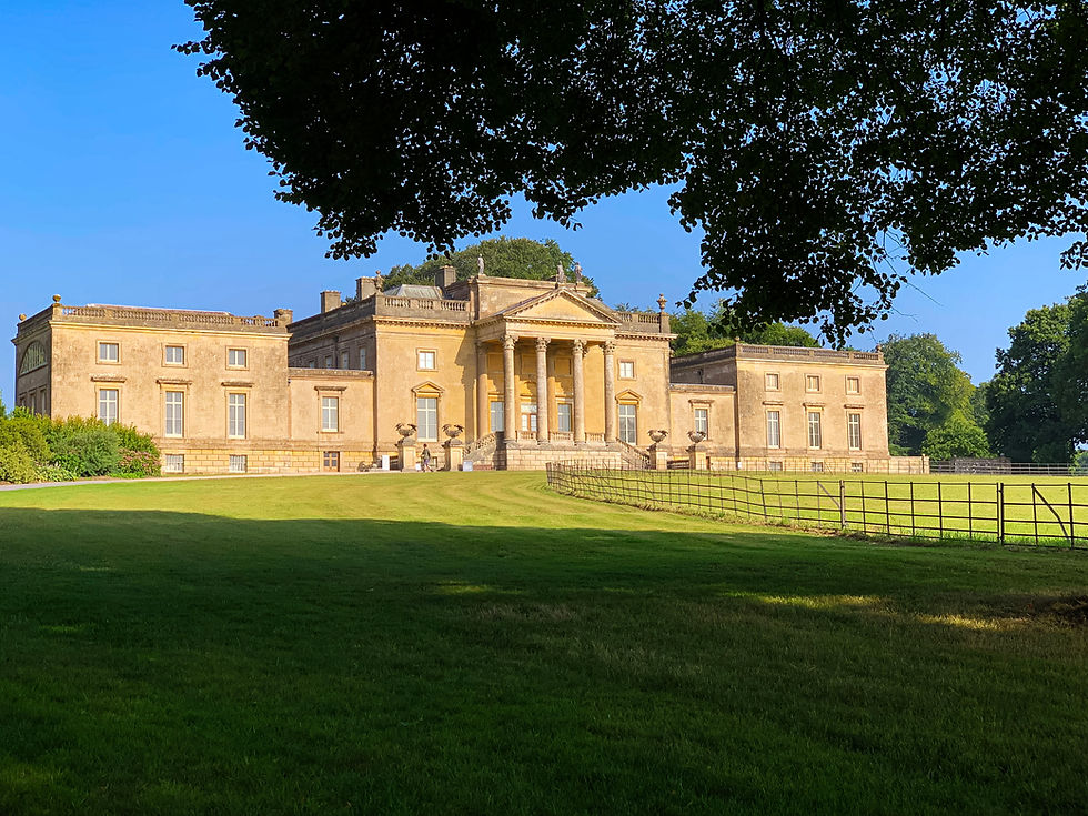
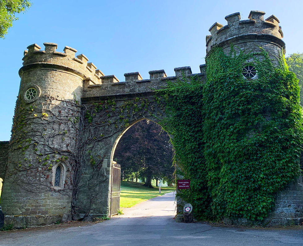
Once again we began our walk at the National Trust’s Stourhead car park. From there, we headed back to the road, turning left towards Stourton and then right through the imposing entrance gate and into the grounds of Stourhead. I briefly wondered how impressed people might have felt back in the day when arriving to visit the antiquarian and archaeologist Richard Colt Hoare or indeed others of the Hoare family whose tremendous wealth was so evidently on display here. From the gate, the drive leads up past Stourhead house, and even though the house doesn’t exactly qualify as “hidden Wiltshire,” its Bath stone Palladian exterior radiated such a wonderful and warm honey colour in the early morning sun that I felt it was worthy of a photograph to share.
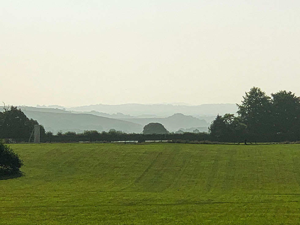
Passing in front of the house, the view to our right was lovely. The misty, treelined hills in various shades of smokey grey gave an impression of some far eastern foreign land, and with the heady atmosphere here, I could have believed this to be so but for the cricket ground in the foreground giving the game away that we were still in Blighty.
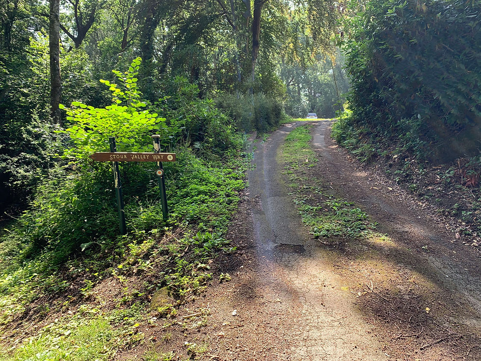
Beyond the house, we turned left onto the start of the Stour Valley Way and what was once the Hoare’s Terrace Ride. Once again I thought of those in the past being treated to a ride around this magnificent estate with its glorious views and wonderful woodland. They would certainly be impressed, but somehow, I couldn’t help thinking of Hardy’s Tess and the fiendish Alec taking a ride together, this acquaintance didn’t end well. Pushing these thoughts aside, we continued on past an obelisk to our left. The golden metal sun on its top shining brightly in the morning sunlight. The monument seemed a somewhat odd addition to this landscaped area of the Wiltshire countryside, but it was probably fashionable in its day, and it certainly had the ability to impress.
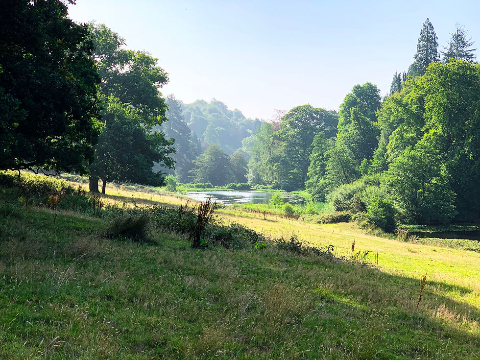
Soon, we came to a gatehouse, and here, the Stour Valley Way bears left away from the ride and descends into a valley where, to the left, one of the smaller Stourhead lakes can be seen, and to the right, St. Peter’s pump can be determined in the distance. The pump stands over one of the springs that form the source of the Stour. As Stourhead is so rich in these springs the headwaters were dammed in the 1700s to create the Garden Lake at Stourhead. A tributary of the Stour then runs on from this lake down towards more lakes and the valley to finally form the main river. This holding back of the water does have consequences as we will see later in the blog.
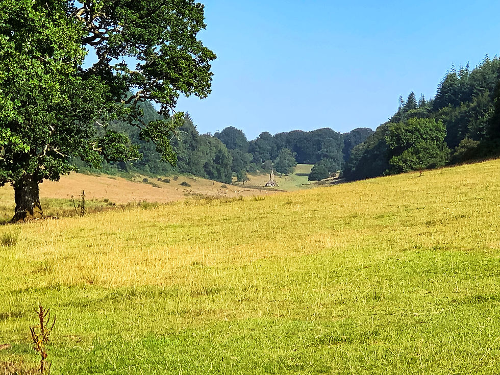
Continuing on, we found ourselves heading into a wooded area with a steep upward incline. It was a difficult climb but the steps at the top were a welcome aid to our ascent. We then found ourselves walking through a pretty gladed area before heading back down an equally steep descent into another valley where again there are the springs that form the headwaters of the River Stour. These are also dammed this time at Gasper to form New Lake. New Lake is also fed by the water from the Garden Lake. Meaning that the dam at New Lake holds back a vast amount of water.

Once in the Valley, we continued on a track that appeared to be in the direction of the pointer for the Stour Valley Way. The actual path continues on to the left of some trees known as Top Wood, but led astray, we inadvertently took a different route. However, we soon joined up with the path that leads down to Gasper. As we looked behind us, we noticed the sweet thatched Top Lane Farm and considered how idyllic a setting it would be to live overlooking such a lovely area.

We continued on over a somewhat dilapidated footbridge and stile and across some fields before finally finding the road at Gasper. The aforementioned “regained” bridleway stretched before us, but we held off from walking along it, as we wanted to see the New Lake.

Standing by it, there is quite a sensation of peace. However, this is the location where, during a severe thunderstorm on the night of June 28-29, 1917, the aforementioned dam collapsed, and the vast amount of water that it had held back flooded the Stour Valley and Blackmore Vale, but although the flooding was extensive and caused a lot of damage, and even though rescues were made when the waters were chest high, the miracle is that, as far as I can make out, there were no human casualties. If the flood happened today, I am not sure that would be the case. (I have added some links below if you wish to know more of this disaster.)

Having visited the lake, we retraced our footsteps and returned to the bridleway. The going was fairly easy, and the bridleway formed a pleasant avenue.

Here and there on gateposts we saw signs stating that it was indeed a public bridleway, and we opened and closed the gates with ease. That is all but the last one, where the gate latch seemed to be seized shut. Try as we could, we couldn’t shift it, and so reluctantly and in a somewhat ungainly manner, we climbed over the somewhat rickety gate and onto the track that would take us towards White Cross. Now we were on familiar territory, as we had come this way during the Selwood Triangle walk.
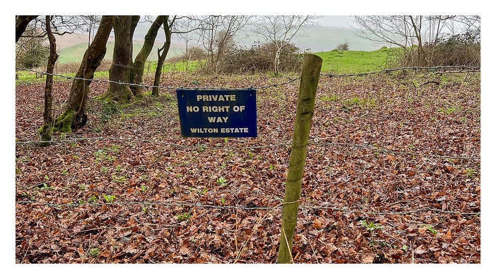
And so we walked on along the muddy diverted route by the stream that forms yet another headwater for the River Stour. Once again we did not get close to the motte and bailey that lies close to the stream. This was because by now, our legs were too weary to exercise our right to walk on what appears to still be the actual right-of-way and then try and find the landowner to see if they would allow us to visit the earthwork. Continuing on, again we struggled trying to remain on the Stour Valley Way. This time, at the Harcourt Farm area, we came across a fence that was too difficult to climb over, especially for the vertically challenged, and so we opted for the road route. No doubt doing just what the landowner wished us to do. We noticed that the OS map suggested it was blocked but passable, but those who reported it must have been taller, and perhaps younger, than me to be able to do so.
Finally, we rejoined the Stour Valley Way and headed towards Bonham, stopping briefly to think of the Stourtons, the family who originally owned Stourhead, and their demise that led them to live at Bonham. I discuss this more in the Selwood Triangle blog but will relate here a comment about the house made by someone who had worked at the property. She said that it was not a happy house, suggesting perhaps that there was a lingering melancholy or maybe even something more supernatural relating to the events of the past.
From Bonham we had two choices, to continue on the footpath across the fields to the car park or to try and find our way through the nearby woodland. As it was getting quite warm, we opted for the trees but once again we became lost and somehow managed eventually to find ourselves outside the Spread Eagle Inn just as the clock struck twelve pm. Sometimes the mischievous deities of the area might well have only the best intentions at heart when leading us astray. Not ones to ignore this kind of thing, we heeded the call for lunch and headed into the pub!

I definitely recommend this walk, which with the diversion to New Lake comes to about 6.5 miles. I supply the route as planned rather than the one we ended up taking, but note the steep nature of the inclines at the beginning of the walk and the yellow blocked but considered passible path sign at Harcourt Farm.


Reputedly the 1917 flood at Gasper reached the outskirts of Gillingham, Dorset - several miles to the South. Up to several feet at Pierston Farm in Milton-on-Stour, I believe. The Mills Bomb factory located at Bourton Mill was also badly affected.
Six Wells/St Peter's Pump at Stourhead also has a 'hidden' Iron Age hillfort located just above it in the woodland, at Shady Hanging, that is well worth checking out. The fort ramparts have been cleared of woodland growth by the NT in recent years. There is a nice forest trail through the hillfort which leads to the area just below the main lake and Stourhead's main boundary.