Dukes and Lepers
- Paul Timlett
- Aug 10, 2025
- 15 min read

We at Hidden Wiltshire have posted over 200 blogs, most based on circular walks in the county. But at some point you start to wonder how many more circular walks are possible? I’m a huge advocate of improving access to the countryside, and when someone says we have plenty of footpaths I always have that thought in the back of my mind. I spend hours pouring over maps trying to connect paths to make a circular walk and it’s becoming a real struggle. So many paths simply end at a main road, with no onward right of way, or you have to walk for hundreds of metres on a busy A road (I’m looking at you A360) to find a path that will allow you to continue on your way. And frankly that would be verging on suicide. If only we could at least walk along field margins in order to connect public rights of way.
So when it came to this walk, I managed to join up a series of paths that would take me back to the starting point. Feeling very smug that I had created a new route, I started to research the area and the points of interest on the way. I then discovered that not only was this not a new route but that it was featured on the new Cranbourne Chase National Landscape website – Walk #43. So instead of stealing walks from Louise Powell I’m now stealing them from other websites! Therefore I’m including a link to the excellent Cranbourne Chase National Landscape website where you will find the walk with turn by turn instructions and a little information about some of the things you can see. That means I can focus here on detail and anecdote, and include plenty of photographs. If you download the leaflet you’ll see parts of it are printed upside down. It is designed to be folded to fit in your pocket. And I would thoroughly recommend that you do so or take a paper OS map with you. I’ve got lazy and rely heavily on the OS Maps app on my phone but as we were to discover there is almost no phone signal anywhere along this route.
Elaine recently posted a blog about her walk from nearby Stourhead (link below). It is pure coincidence that I was planning this walk from Maiden Bradley. I’ve long wanted to do a walk in this area as it’s somewhere I used to cycle a lot. Our bike club would often ride up the long climb through Gare Hill and a hush would descend on the group, not just because we were struggling for breath, but because it always felt slightly eerie – there never seemed to be any birdsong. The countryside here is quite different to much of the rest of Wiltshire. No big open skies but deep valleys and forest. It feels more like Somerset and that’s because parts of this area have been passed back and forth between Wiltshire and Somerset over the years.
The leaflet advises parking at the Memorial Hall on the road to Longbridge Deverill. The What3Words reference is ///attending.strength.feelers. They are happy to permit parking by walkers. I checked this with the Community Speedwatch team who were on duty just along the road (I’ll return to them later) and checked again with someone about to lead a Pilates class in the hall. In fact the car park was almost full – we were to discover why later! So accompanied by my usual walking buddy Stu, we began our walk on a fresh overcast August Tuesday morning. Still T-shirt and shorts weather but we were armed with light fleeces and waterproof jackets just in case.
Maiden Bradley has a long history. The name of the village is derived from the 12th century leper hospital for young women. The word Bradley means a wide clearing or wood - in Old English Brad = broad, and Ley = clearing. The unfortunate young maidens were cared for at what became a priory to the north of Maiden Bradley at what is now Priory Farm (more of that later). But the village history goes back way beyond the priory. There is a Bronze Age barrow in the village which contained a full skeleton and many other artefacts which can be seen at Wiltshire Museum in Devizes. Iron Age and Roman finds were also discovered – we’ll return to the Romans later.
The village was first recorded in the Saxon Charters of 878 AD (Battle of Ethandun anyone). In the 11th century the Lord of the Manor was Tostig Godwinson, King Harold’s brother. Later, in the early 12th century, the manor came into the hands of steward to Henry II, Manasser Biset. It was he who founded the asylum for young girls suffering from leprosy in 1154. It became an Augustinian priory in 1189.
Along came Henry VIII and the Dissolution. The land was given to local landowner Thomas Seymour, the brother of the 1st Duke of Somerset and of Jane Seymour, Henry’s third wife. Thomas grew up at Wulfhall, the Seymour family home. Fun fact – Seymour later married Henry’s widow Catherine Parr in 1547. As a 14 year old the future queen of England, Elizabeth, lived in Seymour’s household where it is said he was involved in the sort of activities with her that would see him locked up today.
Then, as if leprosy wasn’t bad enough, plague struck the village in 1646. It sealed itself off for 10 months to prevent spread, the villagers relying on aid from neighbouring communities. An act of great self-sacrifice worthy of the more famous Eyam in Derbyshire.
It was Sir Edward Seymour 4th Baronet who in, 1688, moved the family seat which by now was at Berry Pomeroy Castle in Devon to Maiden Bradley. The current Duke, the 19th, still lives in Bradley House in the heart of the village. They own much of the land through which the walk passes. More of that later too!
So, back to the walk. As the leaflet instructs, we left the car park and turned right where almost immediately we came to the busy B3092 which brings huge lorries thundering through this poor unfortunate and otherwise pretty village. We had to cross the road to the lane called The Rank on the other side, in front us as we crossed the old village fountain. I can’t emphasise enough how careful you have to be crossing this road. Visibility is poor and drivers routinely ignore the speed limit.

The footpath mentioned in the leaflet that branches off The Rank is not signposted as the gates along much of the early part of the route are being replaced by the Estate. This was nice to see. The fields through which this part of the walk passes all contained maize at this time of year, the crop towering above our heads. But the path follows the field boundary so we didn’t experience that oppressive feel of walking through a tunnel. The views then opened up and to our left on Mapperton Hill we saw what looked like a pyramid in a stand of trees. This was a reservoir over which stands an extravagant structure. Nope, I’ve no idea why but it made for a great photograph!

The instructions in the leaflet were working well as we passed a house across the field in which we were walking before we found our way easily to the lane that passes Manor Farm and the house called Highlands, the whole time Long Knoll looming above us in the middle distance.

It was here that I realised that this was a lane on which I’d cycled many times. It’s strange how different it looks on foot. We quickly came to the gate that took us onto a green lane between hedges, a holloway, and to the first of our main objectives of the day. Immediately to our left was a wooden field gate that I’m hoping is on the Duke’s list to replace. A sign on the gate announced that this was the site of the abandoned Medieval village of Yarnfield and that there was permissive access to the whole of the extensive site.

What a joy to see this. Whilst it doesn’t mean we have a right of access, as permission can be withdrawn, I’m sure the Estate would not do so. Stu and I wrestled with gate which was falling to pieces. We did not want to be the ones responsible for leaving it as a pile of timber! The sign says that you can roam across the whole site and shows where you can leave again to re-join the green lane further down the hill.

I can’t begin to describe how outstanding Yarnfield (or Yarnfield Gate) is. I’ve visited the site of a few abandoned villages, such as Shaw and Snap in Wiltshire, but nowhere I have I found it so easy to see the layout preserved as it is at Yarnfield as banks and ditches – ripples in the landscape. As ever photographs don't show the earthworks well.

We could even make out what was clearly a street and, perhaps, the place where they may have quarried stone for the buildings and walls on the hill above the village by the Kilmington road. I’ve tried to enhance the photograph but the sign on the gate provides the best history of Yarnfield I’ve seen. It’s believed it dates to the late Saxon period and the settlement grew up either side of the holloway. It was large enough to have an entry in the Domesday survey when the settlement was in Somerset and was called Gernefelle. A survey of the earthworks suggested that there were up to ten crofts over six hectares indicating a population of 60-80 people. The village appears to have been abandoned by the mid 15thcentury although it’s not known why.
Stu and I spent an hour or so just absorbing the sights and sounds, imagining the voices of the people who once lived and worked here. Despite the occasional vehicle, horse and bike rider on the Kilmington road above this was such a peaceful place. We remarked that we could have sent all day here. As it was we had only walked a couple of kilometres and we had a long way to go, so we contented ourselves with a coffee, listening to and watching a great spotted woodpecker swooping back and forth across the valley and listening to the rustle of the leaves in the ancient oaks and sycamores. Here is a short video I recorded there.
We followed the instructions in the leaflet to the marshy area at the bottom of the valley then back up to a field gate and stile into the wood. A sign on the other side of the gate warned of a bull in the field but he was not there during our visit. However the cowpats were evidence that the field is used for pasture.

Entering Tyning Wood on one of the two ancient tracks through it, the route is shown as passing to the east of a pond. However the very clear track took us to the west of it so I have shown that route on my map. Follwers of Hidden Wiltshire will know I spent the best part of 20 years splitting my time between Wiltshire and Dordogne. It’s remarkable how similar the landscape in this part of Wiltshire is to Dordogne. I could so easily have been on one of my many walks in the forests of north Dordogne.


Passing some very active beehives we eventually came to the road that passes the hamlet of Gare Hill, a road on which my cycling club used to stage a “mountain” time trial for the fastest time up the long long climb.

Nowadays there is more traffic and the speed of the cars on the road was crazy. We only had to walk a mercifully shorth length of the road to the branch off to the right to the few houses in Gare Hill itself. It was not for the faint hearted. Across the field to our left was what used to be the Church of St Michael, now a private house. Its construction was funded by the Earl of Cork in the late 1850s.

The tiny hamlet even had its own telephone box which still stands opposite the wall of a house which bears the village notice board. Further along the lane,just before we re-entered the woods, was the impressive Parsonage at the end of a long driveway.


The route now took us into Great Bradley Wood, descending steeply to the valley bottom where a number of small rivulets meet, the only sound here the gentle splashing of water over rock in the barely visible streams, hidden at this time of year by ferns.
The woods were living up to my memory of very little birdsong. Whilst there was a good mix of woodland at this point, much of the surrounding woods is fast growing evergreens, mainly Norwegian spruce, and it was evident that forestry is an important industry here. But Stu made the very valid point that the lack of biodiversity may explain the lack of birdlife. Climbing back up out of the wooded valley we decided to stop for lunch, perched on a log and a tree stump under the woodland canopy.

Refreshed we continued along the metalled track, tucking into some of the countless juicy blackberries growing alongside it. We were heading for the road again, the B3092 to Frome. Stu and his wife Susanne recently went to Turkey for a holiday. It was at this point that Stu mentioned that, whilst visiting the Roman ruins at Side, they met an archaeologist who lives in London and who follows Hidden Wiltshire!

Taking our lives in our hands once more by re-crossing the road, our next objective was Priory Farm where we were hoping to see the remains of the priory. The farm is visible in the valley below the road, and a narrow lane climbs towards it.

At the bottom at a junction of tracks by a pond there were two overgrown brick buildings either side of the track. I’m not sure what they are but we assumed a pump house and a small storage shed.

The track up to the farm is to the right just after these buildings alongside the pond. The map shows that a public right of way passes right by the farmyard. As we approached we became slightly nervous. A hideously bloated dead sheep lay in the yard and there was no apparent path. The several warning signs suggested that visitors were not encouraged. There were several vehicles parked up including a pickup with the tailgate open. But there was no sign of life. We loitered for a while on the assumption that someone would see us and at the least ask what we were up to, but all was quiet. We were later to hear that the remains of the priory are well preserved and can be seen in one of the barns. Allegedly the farmer is happy to show people on appointment. But the right of way had either been blocked or we just could not see it so we retreated.
We were also told later that the pond we had passed contained beavers but there was no sign of them either! Once back to the pumping station we turned right and started the climb up into Little Bradley Wood where we turned sharp right following the contours along a forest track towards Maiden Bradley.

The leaflet describes a stile where you exit the wood into an open field but this has been replaced by a metal pedestrian gate. In the field, which the map names as Spring Piece, there were distinct earthworks including what must once have been another track climbing the hill, but the map shows no evidence of anything of note here.
We followed the clear instructions in the leaflet down and across the valley side to reach a small footbridge across a ditch onto the lane past a house, before re-entering fields and climbing back up the valley side towards the edge of Maiden Bradley.
We eventually reached the Longbridge Deverill road along which we had driven earlier that day. Instead of turning right back to the Memorial Hall car park we crossed over into the road opposite that passes between an avenue of trees towards the gate that enters Bradley House. A few vehicles passed up and down so I had to wait a while to get a photograph. Three people were walking towards us on the grass bank so I waited for them to pass as well. Later on, whilst doing a little “research” in the pub it dawned on us that this was the Duke of Somerset, his wife and what we assumed was their son. His wife gave us a cheery greeting as they passed. I now regret being so sniffy about having to wait to take my photograph with no people in it. I could have practiced my curtsy.

At the gates to Bradley House we turned right to follow the road alongside the estate wall, grumbling about why couldn’t the public at least get a glimpse of what by all accounts is a magnificent house! Meeting the Frome road with its continuous flow of thundering trucks we turned left to walk down to the church.

We spent a long while in and around the church looking at the headstones. It’s here that you get a sense of the history and the influence of the Seymours. The churchyard is full of them, a surprising number of whom seem to have adopted German names such as Ferdinand and Adolphus. Bradley House lurks on the other side of a high wall dividing it from the churchyard but glimpses of its grandeur can be caught. It looked as though the roof was being repaired and we were later to find out that the current Duke is moving out to allow his son and heir to move in.

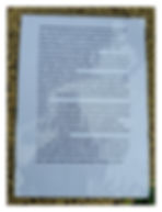
On the aforementioned wall, half hidden in a bush, was a sign. It seems the remains of a high status young Roman woman were found buried in the rose garden of the house in a stone sarcophagus in which was a lead coffin. At some point it was moved to the church. Complaints were received that the church is a Christian place and that the Pagan remains should be removed (not a very Christian act). So the remains were ignominiously re-interred at the base of the wall which bears the sign. An information sheet in the church provides more background and it suggests that the Roman Lead Route between London and Mendip passed on the north side of where the wall now stands, and that it was common for high status burials to be placed next to important highways in Roman times. It was also suggested to us that people should not be surprised if the coffin was once again dug up one night and put back in its place in the church!

Stu and I spent some time in the church, the 12th century All Saints Church,
which to all intents and purpose is a family chapel for the Seymours with memorials that use both that name and the name St Maur. One of them had the misfortune to have been “accidentally wounded by a bear” whilst on a hunt in India! Also in the church is the fascinating turret clock made by William Monk in 1742. It reminds me of the much older clock in Salisbury Cathedral.


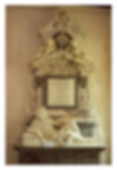
Also of note in the church is the reclining figure of Sir Edward Seymour sporting a periwig that was fashionable at the time. Stu and I had seen a very similar memorial in the church at Ramsbury. What is it about the wealthy of those times and lounging about? The cynical might say nothing changes!
As we left the church we heard the gate go and a figure walked up the path towards us and asked “Did you enjoy our church?” What was to follow was one of those happy encounters that I so look forward to on our walks. This was Simon, chair of the Parish Council (about to stand down) and once Land Agent to the Duke. We chatted at length about the history of the village and of the Duke of Somerset of whom he seemed to have genuine admiration. Simon spoke of their disagreements over estate matters and how the Duke would always listen carefully and take advice. I said that I had been pleased to see that he had granted permissive access to Yarnfield Gate to which Simon replied that the family care deeply about the village and do much for it. He also said that the family open up the house and gardens several times a year but that they are always happy to show people around. He confirmed that the house we see now, which was built in 1821, replaced a much larger building, eight times as large, that was completed in about 1710.
Sir Edward Seymour, the 6th Baronet, inherited the dukedom from a distant cousin in 1750, and so Bradley House became the seat of the Dukes of Somerset. But Simon said that the Seymours came to England with the Cathars whose roots were in Southern France so presumably not associated with the Norman Conquest like so many of the aristocracy today.

Simon, Stu and I talked and laughed for a long time about a wide range of subjects including Stu’s passion for fishing. And remember the Community Speedwatch guys I mentioned at the beginning of this blog? Well Simon was one of them and it was when I mentioned that we had stopped to ask them about parking it dawned on him why he recognised me! Finally, as Simon recommended we drop into the village pub for a pint before we left, I asked him if I could take his photograph for the blog. So Simon, if you’re reading this, it was an absolute pleasure to meet you. And we thoroughly approve of your pub.
We really enjoyed this walk – one of the best we’ve done. We hardly saw anyone during walk itself. The leaflet we followed was invaluable and whilst it says the route is 6.5 miles (10.5 kms) the route I plotted in OS Maps says it’s 7.49 miles (12.05 kms). Whilst there are some steepish climbs we were mostly on well made tracks which made the going easier, although the sections through the various woods could be muddy after a lot of rain.
Oh, by the way. Why was the car park at the Memorial Hall full? As we returned to my car a coach drew across the exit which meant I couldn’t get out. We waited patiently whilst what seemed like numerous very old people were disgorged, and the driver unloaded a dozen wheelchairs and Zimmer frames. The passenge all seemed to have had a jolly time wherever it is they had been. Meanwhile Stu and I were staring at our future.


