
Sarsen Stones and the Devil's Den
- Paul Timlett

- May 27, 2021
- 7 min read
Updated: Jan 19
About four years ago I did a walk on Fyfield Down to see the source of the sarsen stones (also known as grey wethers) from which Stonehenge was built. I decided to re-visit the area this week to refresh my memory but also to see the Devil’s Den which I missed last time. After weeks of seemingly endless rain the day was bright and reasonably warm with a few sunny spells, unlike my last visit when it was blisteringly hot.
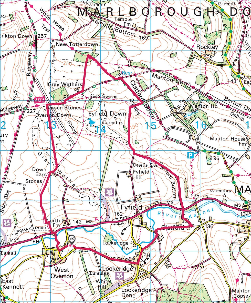
This is an eight mile walk with a multitude of options to shorten or lengthen it. This is an ancient landscape littered with tumuli and the remains of settlements together with the building materials that prehistoric man used to build some of the most important structures certainly in the UK if not Europe. The views, like so much of this part of Wiltshire with its characteristic downland, seem endless. It’s a simple matter to find peace and isolation despite the relative proximity of Marlborough and the A4. Racehorse training is big business here with the word “gallops” appearing several times on the map. A number of long distance trails and ancient tracks also criss-cross the countryside here, including the Ridgeway, The Wessex Ridgeway, the Herepath (or Green Street) and the White Horse Trail.
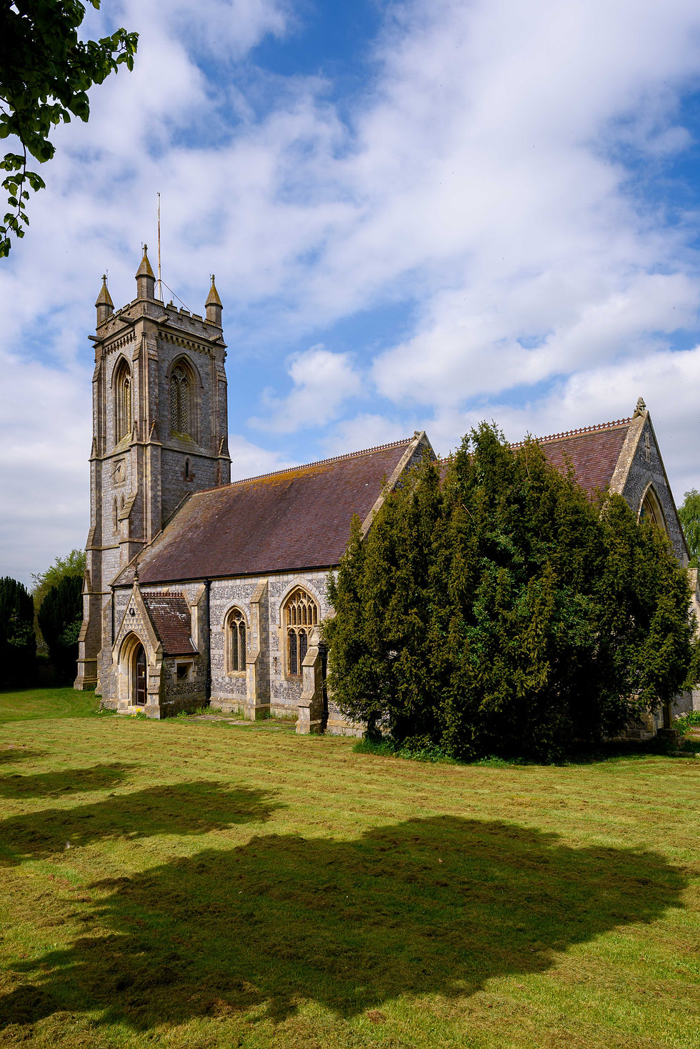
When I first did this walk in 2017 I parked on the grass verge by a short no-though road that leads to the front of West Overton church. This time, with my walking buddy Stu, we did the same and the route on the map below shows the church as the start of the walk. However, since there is really only room for one car (and even then we were a bit concerned that we hadn’t left quite enough room) I would recommend that you park at the Kennet Valley Hall on the edge of Lockeridge, on the road between Lockeridge and West Overton. It has ample room and there were no signs to say parking was not permitted. You can do the same walk but with a different start/end point. But in my route description we’ll begin at West Overton church.
Back in 2017, having left the church, I immediately went wrong. I was looking for the path that takes you across The Withy Bed on the water meadows of the River Kennet towards the A4. I walked right past it last time as it takes you beside a house and the sign is not very visible. However, this time I knew where to find it so Stu and I headed along it. It’s always been quite overgrown but now seemed even worse. And it's always quite muddy because of the sodden ditch that runs alongside it. But today the ditch had become a stream and the footpath had disappeared under about 18 inches of water. We retreated and instead headed north-east across the adjacent fields towards the minor road that passes the church to join the A4 at what is marked as George Bridge on the map. My advice would be that, unless there has been extended dry period, you simply miss this path out and either use the aforementioned road past the church or head to the road on the far side of the village that meets the A4 by Overton Bridge. The objective is the bridleway on the other side of the A4 mid way between these two roads. This involves a walk along the verge by the A4 of about 100 metres from either direction. Approaching from the Overton Bridge direction may be slightly preferable as there is a faint path long the verge.
Crossing the A4 requires considerable caution. It is a very fast busy road. The entrance to the bridleway (and there is no way a horse could get up it) is little more than a gap in the hedge by a house up a steep bank beside the road (see the photograph).

If the bank was very wet it seems to me it would be easy to slip back into the road. We crossed one at a time to allow the other time to get up the bank and through the gap in the hedge. Once safely across you soon leave the deafening noise of traffic behind as you head north towards Down Barn and the gorgeous thatched Down Barn Cottage. This is a place I could quite happily live. Tucked away on its own at the head of the valley and accessible only along the track this is the most idyllic and peaceful spot.

From here we headed almost due north and gently upwards across the downs through a field littered with sarsen stones towards Fyfield Down National Nature Reserve. The map is dotted with references to the landscape’s Neolithic and early Bronze Age occupation – the words “mound”, “enclosure”, “field system”, “tumulus”, “settlement”, and “earthwork” all appear one after another in the half mile or so before the path’s junction with the Herepath trail. Herepaths (or herewegs) were military roads often using ridge top routes and dating back to Anglo-Saxon times. This one may have been used by King Alfred’s troops during the war against the Vikings.

From this point we turned due east and crossed the first of the day’s gallops heading towards the south-east corner of Delling Copse.
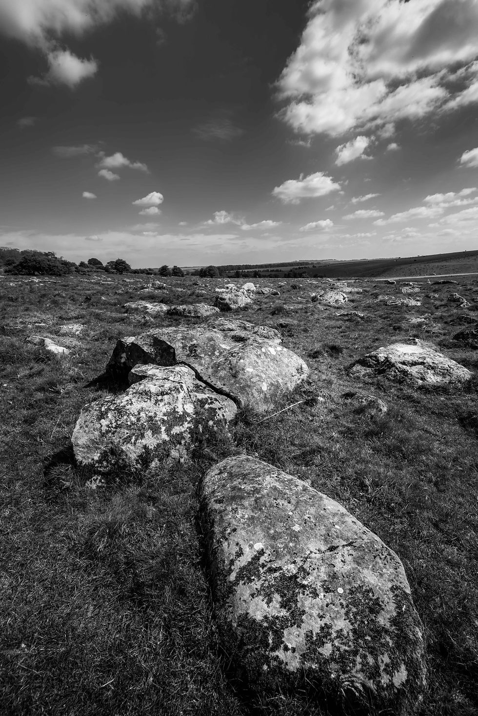
Ahead of us the chalk scar of Herepath (also known as Green Street – the medieval road from London to Bath, it is also the Wiltshire Ridgeway) snaked upwards in a north-easterly direction. This whole area is a sea of sarsen stones. Prehistoric man had an ample supply. There are many route options here and we could have followed any one of them but having met the couple in the photograph coming down the hill along the Herepath who told us about the bluebells in Totterdown Wood we decided to head there.

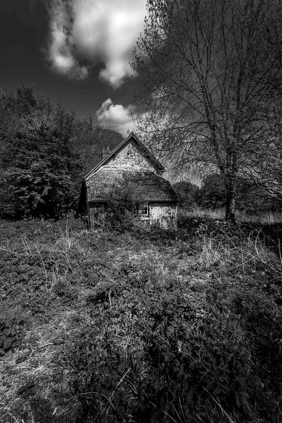
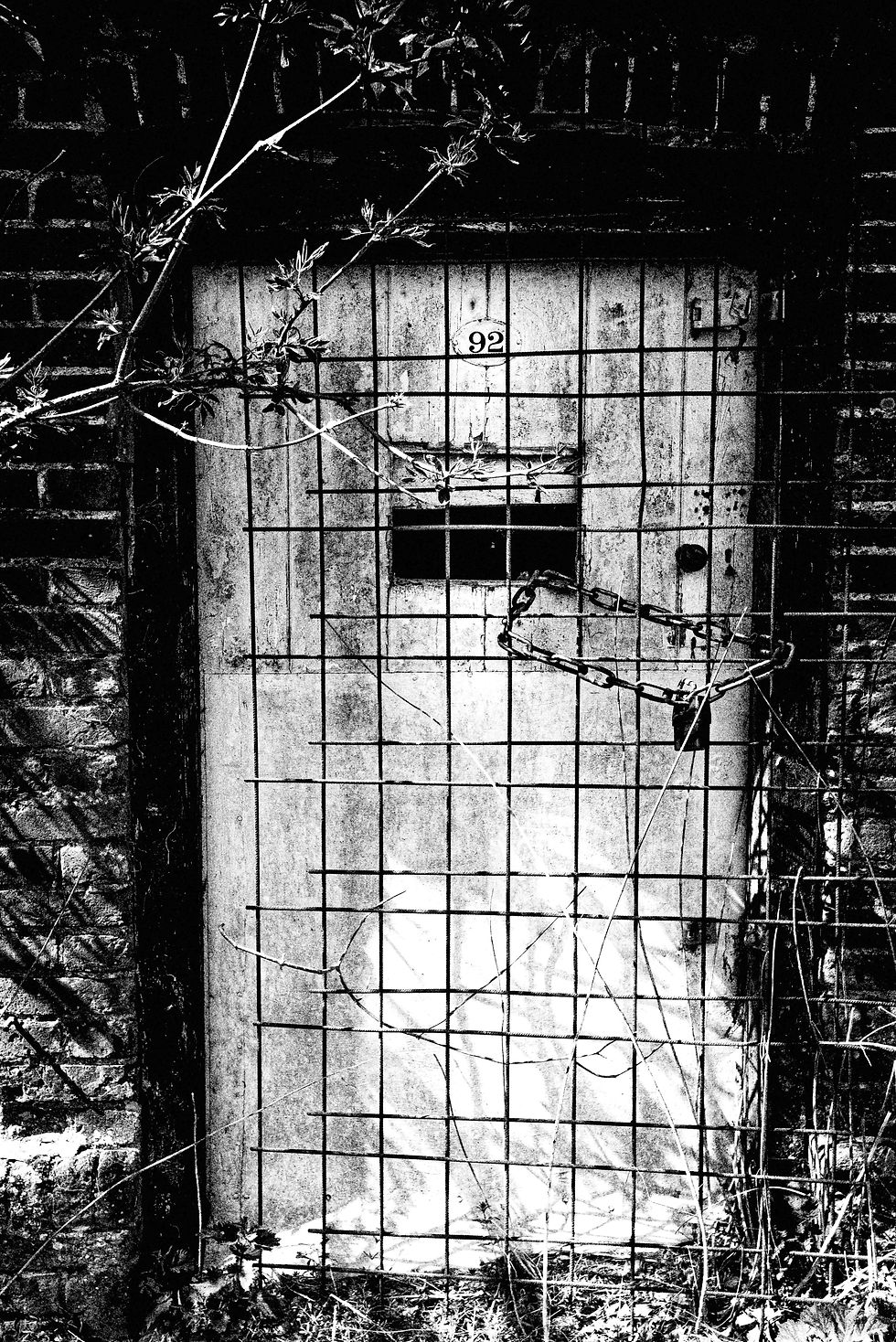
Next to Delling Copse and on the edge of the open access land south of Totterdown Wood is what is shown on the map as “Beech Circle”. Next to this, and almost totally overgrown, is the remains of a house known as The Delling. When I did this walk in 2017 I went through the gate to have a look at this house and Beech Circle. As the photographs show the house is gradually being absorbed by nature. There were signs of some form of rituals having taken place in the wood in recent years. The area is now fenced off and the gate locked but the house appears to have deteriorated further since I last visited. Whilst writing this I found some estate agent details for a substantial area of land with sporting rights in the area and which included the house. It was described as being “… set in a secluded position” and as having been “... redundant as a dwelling for 30 years… and in need of substantial renovation to bring it back to its former glory”. Estate agents are nothing if not masters of understatement. The land may have sold but the house clearly didn’t appeal!

Totterdown Wood was worth a detour, with the path crossing another area of ancient occupation that included what is probably a medieval quarry pit. The bluebells in the wood were fairly extensive but definitely on the wane. I took some photographs but will spare you those. I think we’ve all seen enough for one year!
From the wood we followed what was now the White Horse Trail (which passes through the wood). Again it’s possible to take any number of rights of way here but we continued alongside another set of gallops across Clatford Down in the rough direction of Manton House before turning right across Fyfield Down.

Our next objective was the Devil’s Den. We crossed the open expanse of Fyfield Down to a shallow valley filled with sarsens looking in the direction of Wroughton Wood at the head of the valley above. This valley is known as the Valley of the Stones. Our path had been blocked by a fence (another one to report to Wiltshire Council) so we were forced to climb it.

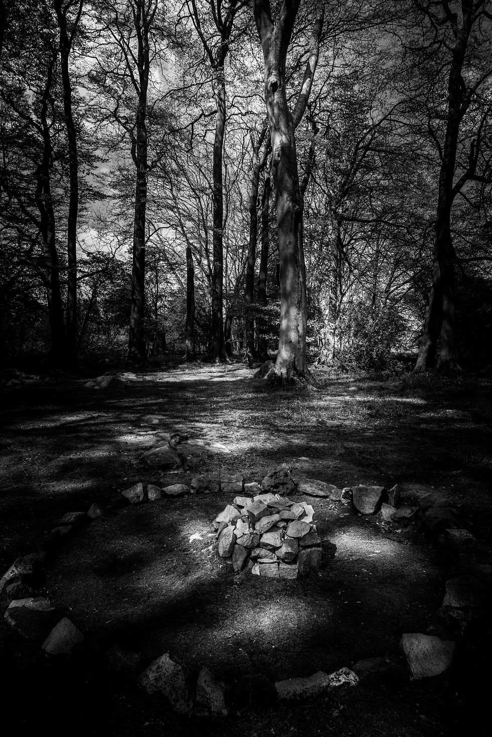
The Devil’s Den was far easier to find than I expected, being beside the track that runs along Clatford Bottom. As you can see from the photographs the surrounding fields were filled with the vivid yellow of rapeseed which provided a stark contrast to the grey of the stones that make up the monument. It was larger than I expected. Wikipedia describes it thus – “The Devil’s Den is a dolmen burial chamber on Fyfield Hill near Marlborough, Wiltshire, England. The chamber is part of a Neolithic passage grave on Fyfield Down. Two standing stones, a capstone and two fallen stones are all that remain of what was the entrance to a long mound, described in the 1920s as being around 230 ft long. The capstone is believed to weigh 17 tons. The burial chamber was reconstructed in 1921”.


Having spent some time here we continued along Clatford Bottom towards the crossing of the A4.


This crossing can only be described as precarious as the bend was blind to our right. Stu stood on the raised grassy bank and shouted when it was clear for me to cross. From the other side of the road I had a good view and could return the favour. At this juncture you walk up the drive towards Clatford Hall. It’s worth pausing as you cross the bridge over the River Kennet. Just before the Hall the right of way turns left but you get a good view of the front of this sturdy looking 16th century house built partly of the local sarsen stone.


The right of way continues around and behind the gardens of Clatford Hall as it makes its way towards Lockeridge. More in hope than expectation we were looking forward to a pint in the Who’d Have Thought It pub but sadly it was closed (unlike when I passed in 2017). I have to say it was looking very sorry for itself. As a Wadworth pub I assume it has been sold and was now very run down.
The final stretch of the walk was along the road from Lockeridge to West Overton. If you park at the Kennet Valley Hall you’ll find it on your right. Since we had parked by the church at West Overton we had a little further to go.
In all this was a splendid walk, once again with reminders everywhere of Wiltshire’s prehistoric past. With so many route options you can turn this into a much shorter of longer walk whilst still taking in the widespread fields of sarsen stones.


I did this walk yesterday and really enjoyed it. Thank you for posting.