
The Smallest Village in Wiltshire?
- Paul Timlett

- Sep 28, 2025
- 11 min read
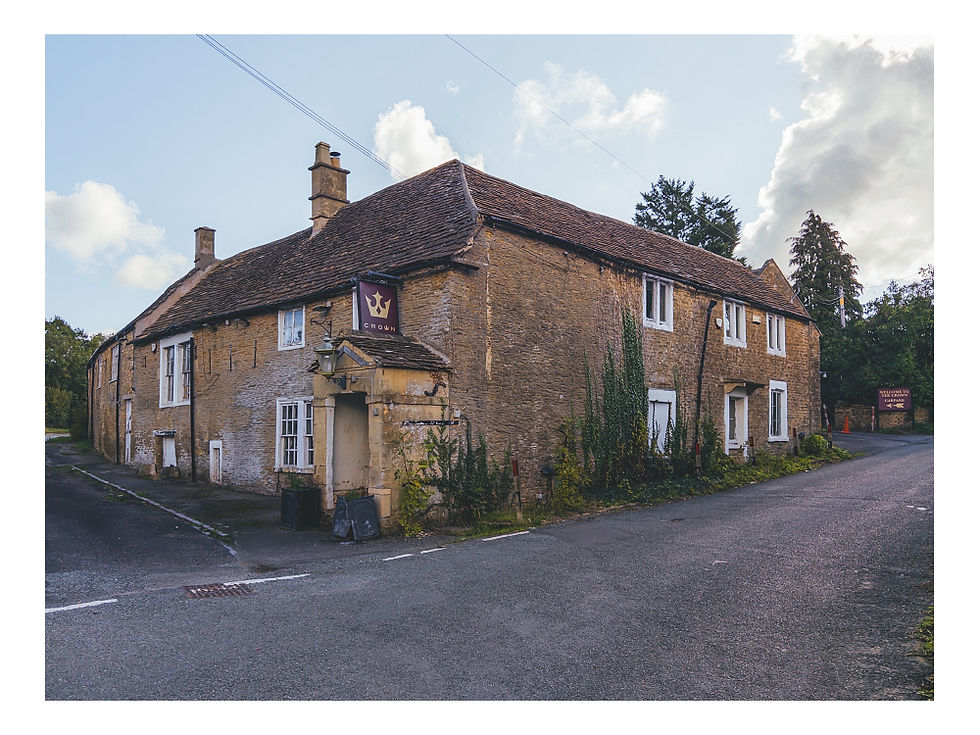
Fresh from a three week trip photographing in southern Ireland I was keen to get back into the Wiltshire countryside. Looking for inspiration my walking buddy and neighbour Stu mentioned a walk he’d seen in Country Walking Magazine. The starting point was the village of Giddeahall, a place neither of us had heard of. Having studied the map we knew exactly where it was but neither of us could remember seeing a village there, despite having driven past many times. We recalled seeing a pub at the side of the A420 west of Chippenham but nothing else. Intrigued we set off on a bright, fresh September morning as autumn began to reveal her wares.
As the Satnav in my car announced “you have arrived at your destination” we both scratched our heads. There was The Crown pub on a side road by the A420, but where was the village? The pub has sadly been closed for several years and is slowly crumbling. I recall going in once, decades ago, but remember nothing about it. The magazine article suggested parking in the side road a few metres west of the pub, so that’s what we did. The road turned sharp right towards Biddestone by the pub and there was a house on the opposite side of the bend. Whilst it was not the direction we would be walking I had a quick look expecting to see the rest of the village. Nothing. Returning to the car we headed west along the side road to begin the walk.
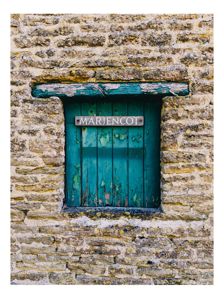
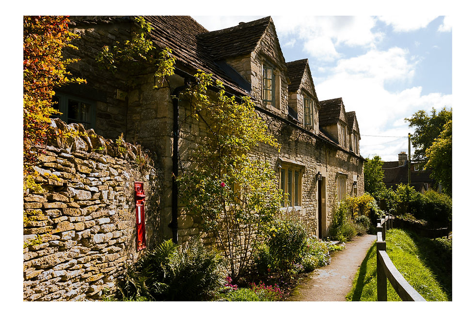
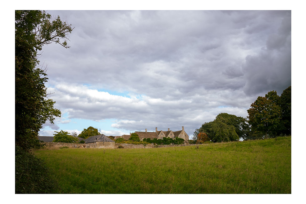
We soon passed Pewshill Farm and then found another house – Marjencot. And that appeared to be it. That was Giddeahall. It didn’t even have a village sign.
An internet search revealed almost nothing except one dubious website that claimed Giddeahall had a primary school and a manor house. It doesn’t. However in writing this I managed to find out a little more whilst I was researching Yatton Keynell which the walk was to visit later, so read on. Meanwhile I’d love to know how to pronounce Giddeahall!
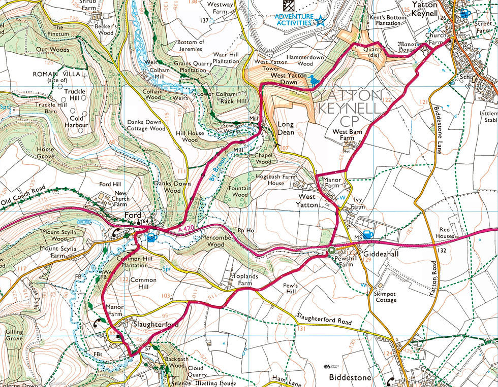
We were a little dubious about this walk as much of it seemed to be on roads, but at least that would make it accessible to more readers. As it turned out the roads were mostly tranquil country lanes where traffic was never a problem. Country Walking Magazine provides a QR code with each walk which links to the route on the OS Maps app, so I’ve provided a link to the route below. You will see numbers on the map which provide turn by turn instructions for each section although we just followed the map without difficulty.
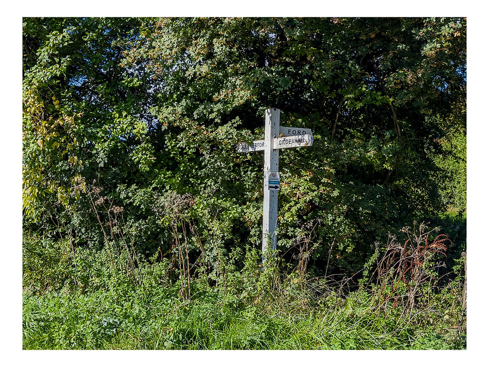
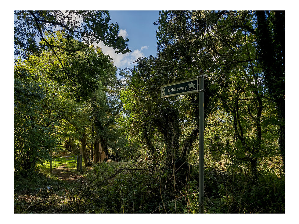
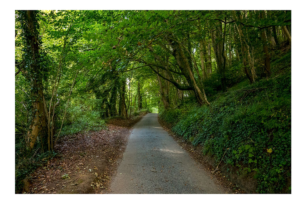
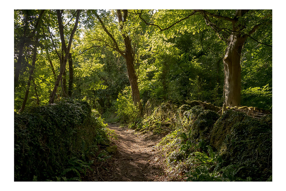
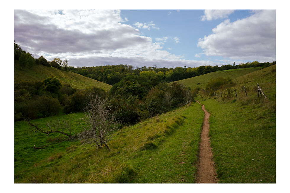
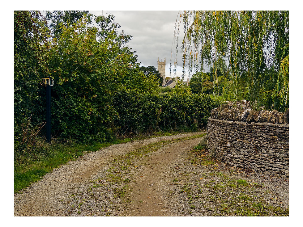
Our first objective after leaving Giddeahall was Slaughterford. Back in July 2020, just after the first COVID lockdown, I did a walk starting on the edge of Castle Combe. You will find a link to my blog at the end of this blog. This walk would follow a couple of sections of that earlier walk beginning at the lovely little village of Slaughterford. The first kilometre or so from Giddeahall to Slaughterford is on a quiet lane. But keep a careful eye on the map to ensure you don’t miss the bridleway on the left.
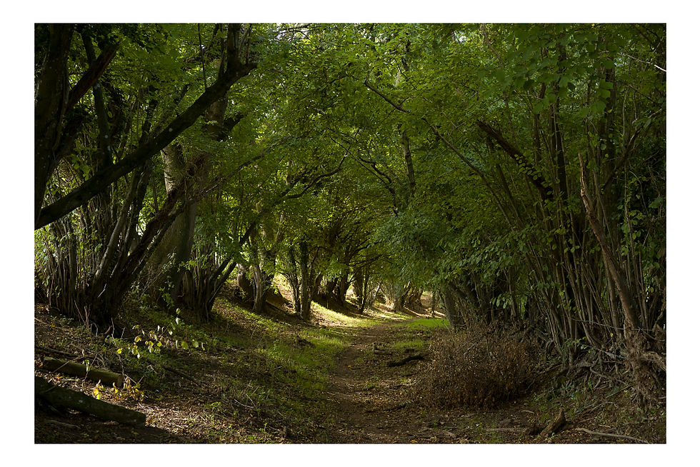
We were busily chatting away about Dickie Bird who had just passed away, and missed the turn. So we had to backtrack for 200 metres once we had realised our mistake. The bridleway can’t be seen from the lane but there is a wide grassy field entrance with a broken field gate. To the right of the gate you will find the bridleway sign and a metal pedestrian gate leading to a well worn track beneath the trees.
As we followed the track its path cut deeper into the landscape signifying its use over many generations. About halfway along, the bridleway continues straight ahead becoming deeper, steeper and muddier, although coming off the back of months of very little rain this was no problem at all.
But in hindsight it may have been more pleasant to take the footpath that branches left and crosses open hillside. The footpath rejoins the bridleway after a couple of hundred metres, crossing a stile and descending a flight of wooden steps to join the bridleway at a narrow lane.
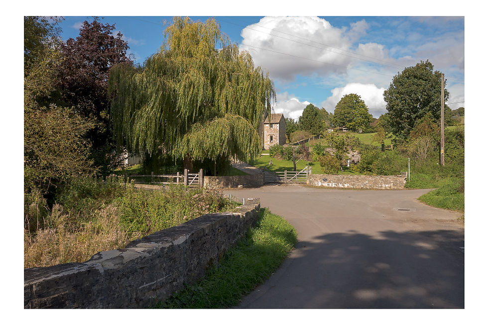
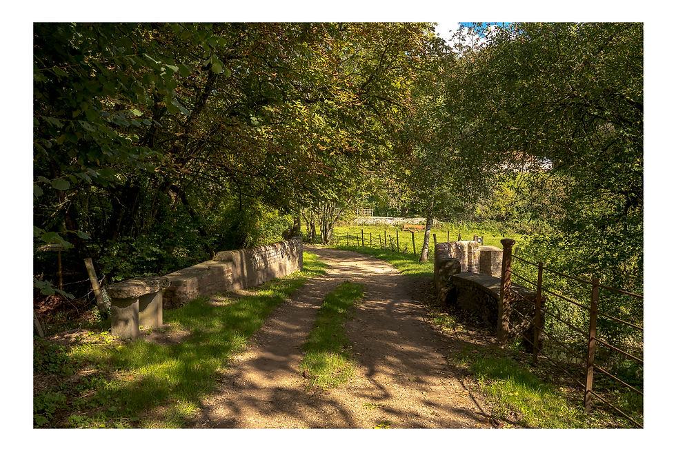
This lane soon joins another by an ancient stone bridge that crosses the By Brook river. A delightful spot where a large weeping willow partially obscures a grand house by the junction, the By Brook gurgling gently away beneath the bridge.
The lane takes a sharp right turn at the point at which my 2020 walk emerges into Slaughterford. On that walk I’d passed by the old Rag Mill, which is signposted through a pedestrian gate on the apex of the bend next to the 18th century Brook Cottage. Since this walk is relatively short you may want to take a short diversion to the site of the mill. I won’t repeat what I wrote about the mill here. You can read that for yourself in my 2020 blog.
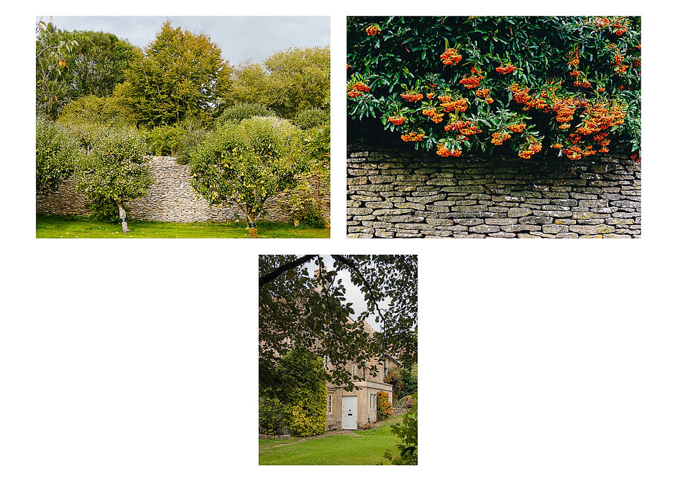
What I have repeated here are some of the photographs of Slaughterford. There is a delightful pair of 18th century stone cottages high above the road which I photographed again. Unsurprisingly these are called High Cottages.
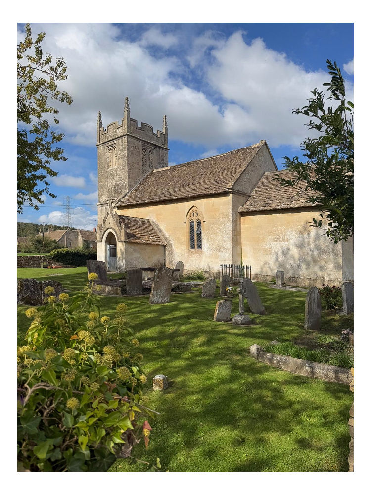
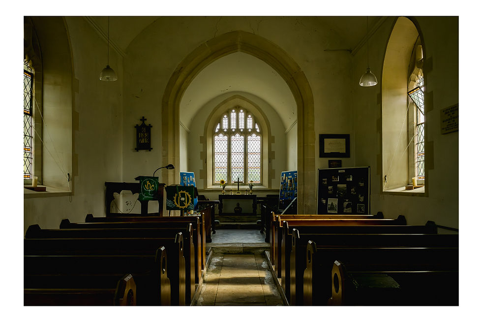
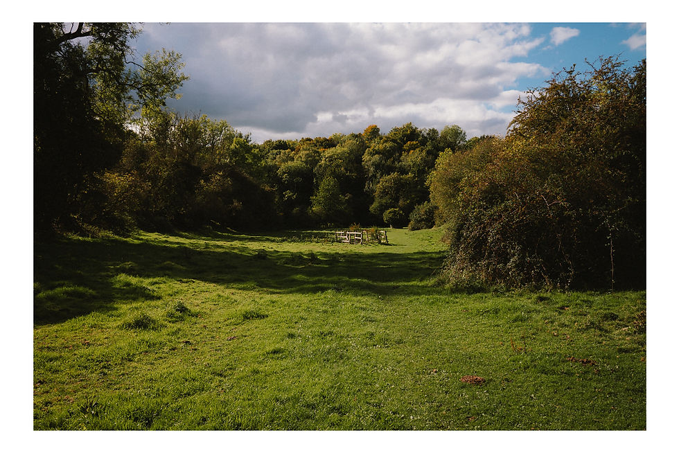
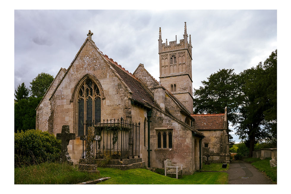
Beyond you will find a gate into a field in the middle of which stands the 15thcentury Church of St Nicholas. I cannot pass a Medieval church without going inside, and this was no exception. It was interesting to read the stone plaque inside that said the church had lain in ruins for 200 years before being rebuilt in 1823. It being a warm sunny day we found a sheltered spot on a bench in the churchyard and had a coffee. Bless his cotton socks Stu had brought a couple of pastries to share. So the least I could do was share his photograph of the church from the iron gate into the churchyard. Don’t tell him, but it’s a better shot than the one I took!
We crossed the field behind the church to a gate on its northern boundary. Two very large well groomed horses occupied the field but they ignored us. After the gate there is a steep drop into a lane so be careful here. A car passed just as I stepped down. We then took the even narrower lane opposite that would lead us north to Ford. This lane is very narrow with no passing places for the first couple of hundred metres. If a car had passed we would have to have flattened ourselves against the steep banks either side. If a tractor had passed we would have to have retreated back along the lane. But we were lucky. The lane passes beneath a canopy of trees for much of its length and descends steeply in the later section towards the junction with another narrow lane at Ford.
I remember riding down this steep hill with my cycling club many years ago just after it had been re-surfaced. Even back then councils never bothered rolling the surface and the hill was an ocean of loose chippings – absolutely lethal on a bike. We all carefully came to a halt, hardly daring to touch our brakes for fear of locking up a wheel, and walked the steep descent… apart from ex-Para Mark who simply accelerated and shot down the hill at breakneck speed. How he didn’t come off I have no idea.
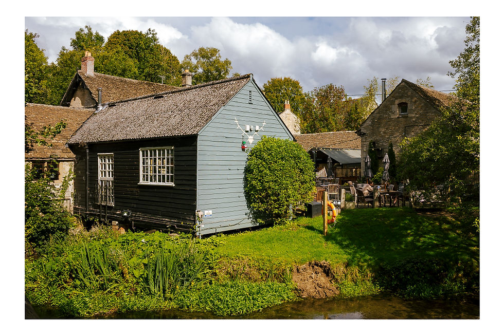
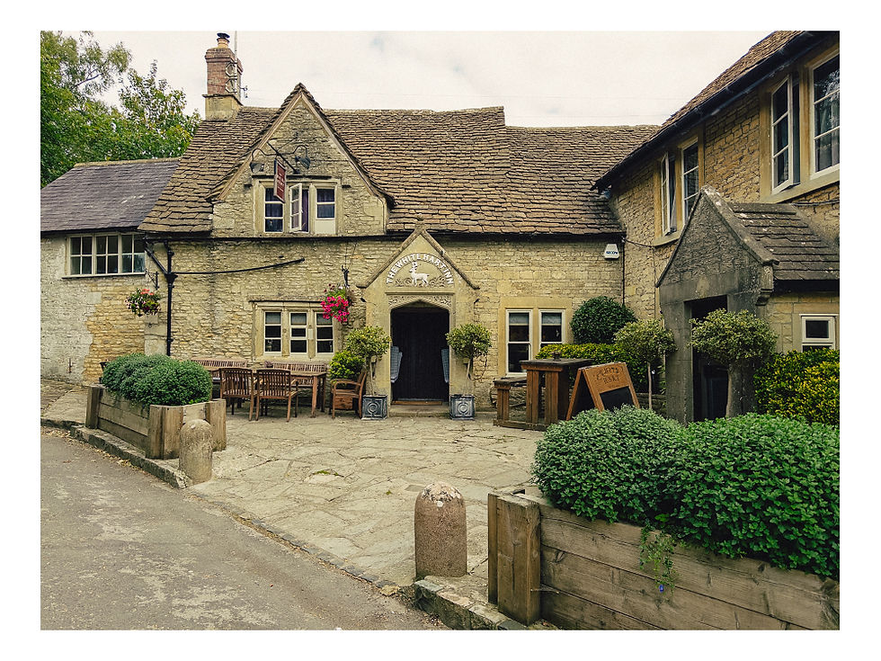
At the bottom of the hill can be found the wonderful White Hart Inn. It may have been only 20 minutes or so from our coffee break but we could not resist the temptation. We spent a very pleasant half hour sitting in the sun by the river with a gorgeous pint of Otter Amber. We seriously considered ordering lunch but when we saw the size of the fish and chips we decided against it, discretion being the better part of valour. We would still be waddling our way round the walk now if we had succumbed.
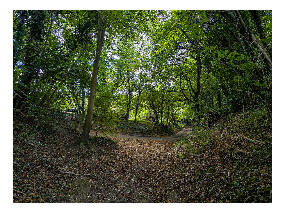
From the pub we walked up to, and crossed, the A420 not that far from where we had parked earlier. Being early afternoon on a weekday, crossing wasn’t too bad. But cars whip past this spot at tremendous speed so care needs to be taken. Walking east for a short distance we then turned up the lane towards Castle Combe, just as I had done in July 2020. The road climbs steeply and we both found ourselves panting like a pair of steam engines. As the climb flattens out and the road curves to the left there is a gate leading into a meadow on the right. The walk follows the route of The Macmillan Way along this stretch. Since we had abstained from lunch at The White Hart Inn we searched for somewhere to sit and eat our sandwiches. We thought we’d found a suitable spot on some old timbers until we noticed a large number of bees that seemed to be entering holes dotted in the earth around the timbers. Some sort of burrowing bee. So we continued to the nearby gate where the path becomes a holloway through trees.
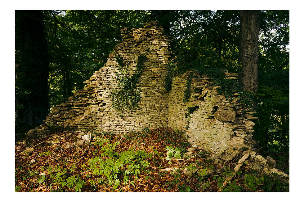
Just beyond the gate in the wood was a ruined stone building. We stepped over the broken barbed wire fence for a look. There is no Historic England listing for this building so we assumed it must have been a barn. It was built right on the edge of a steep ravine. We puzzled over the fact that the track passing the ruin was bounded on both sides by dry stone walls. In my mind this signifies that it was once a track of some importance – why go to the trouble and expense of building a wall either side otherwise?
It slowly descended until we passed the gable end wall of Lower Long Dean Mill. What we see today is what remains of an 18th century mill, now a beautiful house. What can be seen from the track belies its size. A little further on we came to a bridge over the By Brook. The stone parapets provided the perfect place to sit and eat our lunch. This was such a beautifully peaceful spot. The only sound was the river.
As we sat eating a guy emerged from another footpath behind us with his old black labrador. We chatted to him about the history of the area and asked if he knew whether the dry stone walled track we’d been walking signified its importance. He wasn’t sure but he said he thought the footpath to the south on the other side of the bridge from where we sat was older and of more importance. He recommended a walk along that path as well as there are the remains of another unlisted mill along that path. Sadly that will have to be for another day as we still had some way to go. But having said that I can see no other buildings marked on today’s OS map or the 1844 map.
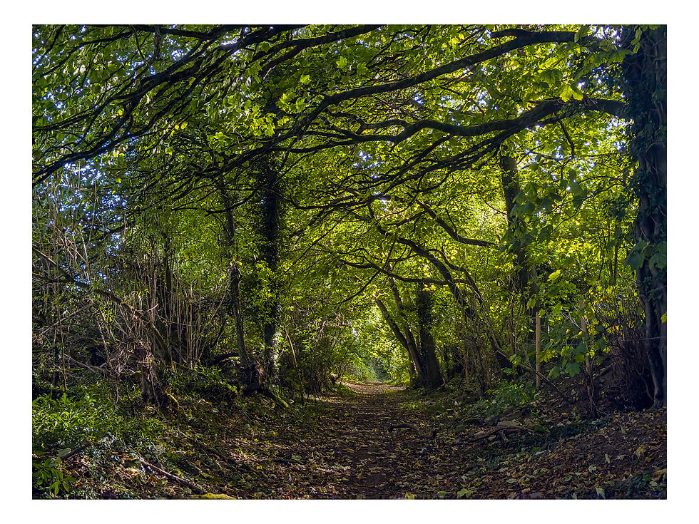
Just after the bridge, around which are gathered some beautiful listed stone houses, we parted company from the walk I did in 2020. This little hamlet, which the guy we had spoken to referred to as The Dean, seemed an idyllic place to live. But I do recall speaking to the owner of Lower Long Dean Mill in 2020 who said its proximity to Castle Combe meant that in holiday periods the track is a steady stream of tourists, and indeed whilst we sat eating lunch two Americans walked past. My route back then took me round to the left and uphill past Upper Long Dean Mill, but on this occasion we continued along the valley bottom until we reached another lane. Opposite the junction was a gate into our next main objective – West Yatton Down. Our hidden gem.
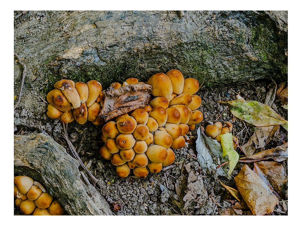
I’d never heard of West Yatton Down. A sign by the gate suggested it is a Wiltshire Wildlife Trust nature reserve but it’s not listed on their website. It is a Site of Special Scientific Interest (SSSI) and is an Open Access Area so you are free to walk anywhere. True to the spirit of Hidden Wiltshire this really is hidden Wiltshire at its finest. The reserve is tucked away out of sight and out of mind. The tranquillity is almost overwhelming. The steep valley sides shelter it from both sight and sound. Nine species of orchid and more than thirty species of butterfly can be found here together with the rare bastard toadflax. Hawthorn and blackthorn bore their fruit in profusion, the red berries contrasting with the deep purple sloes. We saw many devil's-bit scabious hanging on into autumn, whilst the various different funghi gave a foretaste of what the new season would bring.
Buzzards soared above us then descended to tree level, untroubled by our presence. This really is such a beautiful place and fortunately it is far enough from any road to mean that we had it to ourselves. Sheer perfection.
Exiting the small reserve through a gate the path follows the valley bottom through a tunnel of trees until it reaches another Open Access Area which, according to the OS map, is a disused quarry to the south of Yatton Keynell. However, the quarrying has left little mark on the landscape and it felt like a continuation of West Yatton Down. But stone for local houses was quarried here to at least the 1920s. It’s at this point when I was researching the history of the quarry that I discovered a connection with Giddeahall which apparently provided a handful of quarrymen. Looking at old maps there were several quarries dotted around the whole area.
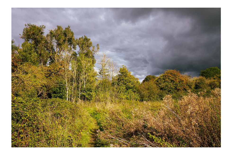
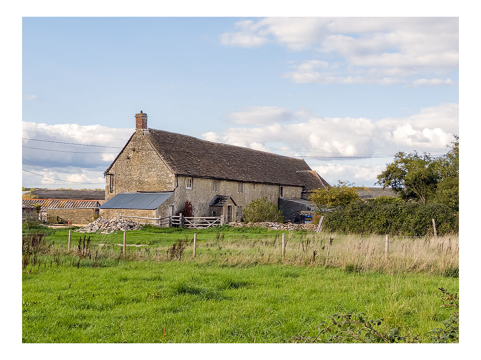
The sky darkened at this point and we thought we were in for an unforecast storm. But the heavy black clouds rolled past and the sun came out again, which was just as well as we had not brought any waterproofs. We followed a sunken track that must have linked the quarry to Yatton Keynell past a barn next to the Tudor Manor House.
The manor dates to at least 1659. I’m not sure who it was built for but it was occupied by the Snell family in the 17th century, so presumably they commissioned it. Again my research on the parish of Yatton Keynell took me to another reference to Giddeahall. In 1773 it was known by the nickname “Giddy Hall” and later became Giddeahll. Was there once a grand house, a hall, in that part of the parish?
From the Manor House barns we followed the lane into the village itself, or to the church to be more precise.
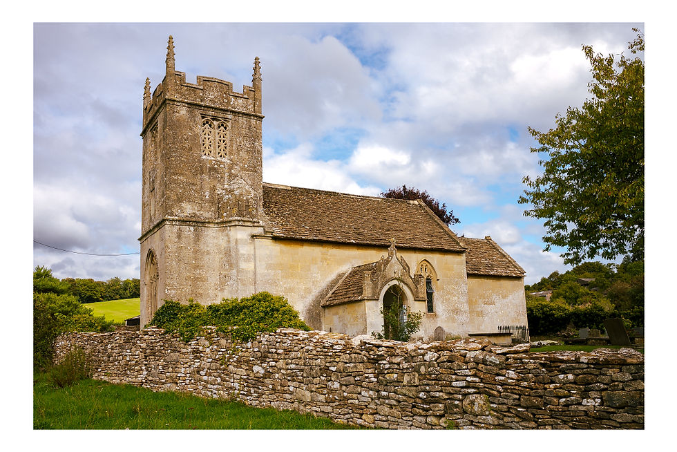
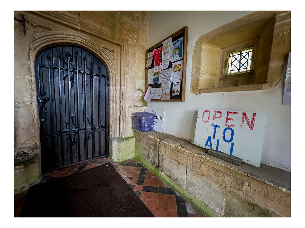
St Margaret of Antioch’s church was built in 1250 by Sir William Keynell as thanks for his safe return from the Crusades. But not much remains of the original building, it being "drastically restored" in 1868 according to the ever blunt Pevsner. I’d like to tell you about the interior of St. Margaret's but notwithstanding the large sign in the porch the door was firmly padlocked.
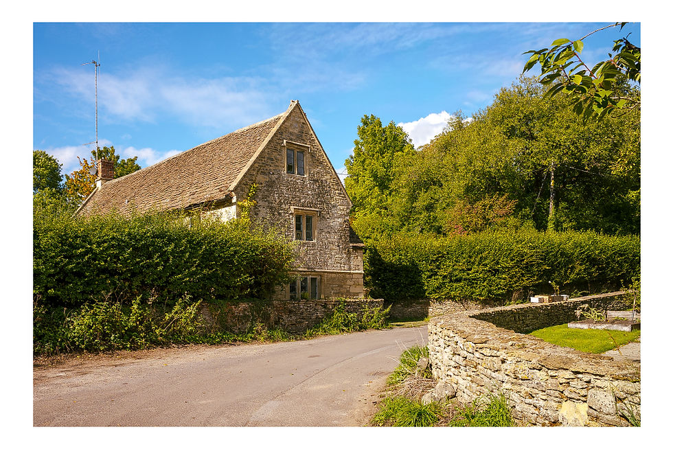
So we re-traced our steps along the lane past the Manor House and on towards West Yatton, passing West Barn Farm along the way. As we passed by I remarked that the buildings were of a great age but I hadn’t appreciated quite how old this farmhouse was until later. Built in the style of a Tudor long house with adjoining barn it dates to 1616.
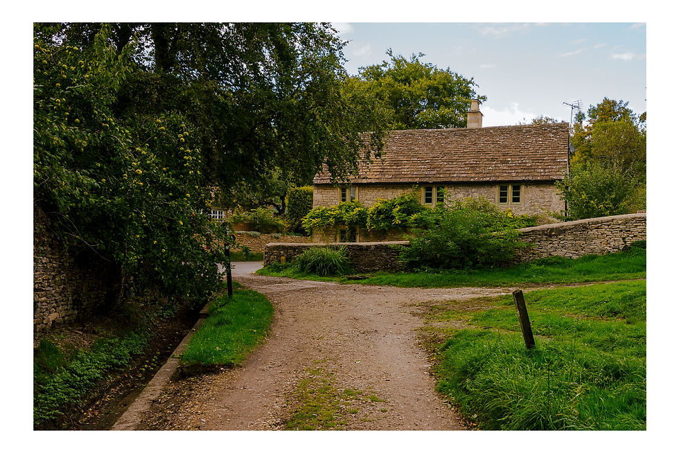
Shortly after we left the road through an almost hidden gap in the hedge on our right to join a footpath across the fields. This eventually joined the quiet lane through West Yatton with its many listed buildings including the 18thcentury manor house at Manor Farm.
Reaching the village green we ignored the road leading back to The Crown at Giddeahall and instead walked along what is described on the OS map as a "route with public access" to the right of the road. This tipped us out onto the A420 which, it being around 5:00pm, was now busy with commuter traffic. We had to wait a while for a gap in the speeding traffic before we could cross safely and walk back up the side road towards The Crown and my car.
This turned out to be a thoroughly enjoyable easy going walk. Although I’d walked short stretches of it before, much of it was new to me. There’s a long and rich history in this part of the world. And West Yatton Down was a real hidden gem, a place I'll be returning to in the spring for sure. In all the walk as mapped measures about 9.3 kms/ 5.8 miles. I mentioned that we had taken this route from Country Walking Magazine. We think the author was Nigel Vile so we're very happy to credit him for this lovely walk.

Thanks for sharing this Sean. I love hearing about people’s own experience of doing our walks. Someone else contacted me to say he had also completed the walk, I think the day after I posted it. I do hope too many people don’t flock to that nature reserve!
Thanks, we did this walk yesterday, although, as you say, perhaps thanks is really due to Nigel Vile. Mr. Vile is so prolific when it comes to walking books that your comment prompted me to look him up to see if he was real, or if 'Nigel Vile' was a code name for a syndicate of some sort. But he seems to be a bona fide human; there are even online photos of an amiable-looking middle-aged man bearing his name.
As for the walk, it was, as you also say, excellent. We decided to start in Yatton Keynell and the village hall car park there is very spacious. Unlike for you, church was open, but the cafe at the community…