
Copehill Down, Salisbury Plain
- Paul Timlett

- Jan 28, 2019
- 3 min read
Updated: Aug 10, 2025
If you've ever driven (or ridden) along the B390 road between Shrewton and Chitterne, or the minor road between Chitterne and Tilshead, you may have noticed in the distance what appears to be a village on Salisbury Plain. Curiosity may have led you to look at a map to find out what this mysterious village is, only to find that it's not marked.

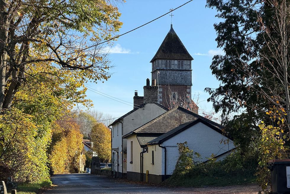
Well, wonder no more. This village is often referred to locally as the German village (or sometimes the Iraqi or Afghan village). It is in fact Copehill Down and it is a Ministry of Defence training facility. The Wikipedia entry says "It is a 'FIBUA' (Fighting In Built Up Areas) urban warfare and close quarters battle training centre where exercises and tests are conducted.
The facility was built in 1988 to resemble a German village in Bavaria, to provide troops with a simulated backdrop when training for operations in European theatres including the Cold War, the Balkans and Northern Ireland.
In recent years the facility has been expanded to include a shanty town made up of cargo containers stacked and laid out in rows of tightly packed streets. Non combat access to Copehill Down is generally restricted.

I drove up to Copehill Down using the network of Byways that criss-cross this part of Salisbury Plain. There was a lot of military activity and whilst the Byways go right past the village I was a little nervous of getting too close with a camera and long lens. I've taken photographs up there before, even whilst urban warfare training has been taking place. The thunder flashes and blank rounds from light machine guns can be deafening. However, today I ran out of time (and nerve) to get too close.
The photographs I've posted here are views of the village both from the south and the north. I've also posted a photograph of one of my favourite "Wiltshire Clumps", a stand of beech (I think) trees, around 500 metres to the east of the village.

As I was preparing to leave I saw in the distance two RAF C130 Hercules aircraft heading towards me. I knew exactly what was going to happen! Just to the south of the village is Fox Covert, a parachute dropping zone. I grabbed my camera which I had packed away in the boot of the car just in time to see a single parachute emerge from the loading ramp of the second Hercules. Unfortunately I had the wrong lens on the camera and had almost no time to change the exposure settings. So I duplicated the image on the computer, overexposing one and underexposing the other, then blended them to get the drama of the sky whilst retaining some detail in the aeroplane.

Both aircraft did a number of passes but sadly no more parachutes. However, it did enable me to swap lenses, adjust exposure settings and get a better shot of the Hercules with the 50th Anniversary colour scheme.
Next time I'll develop a backbone and take some photos of the army at work in the German village.

It is located at Ordnance Survey map grid reference grid reference SU017453.
Images copyright: Paul Timlett


Comments