
Egbert’s Stone, The Harrow Way and a Splendid Bottom
- Paul Timlett
- Nov 8, 2023
- 11 min read
Updated: Nov 10, 2023
Once again I return to a landscape that has a special hold on me. One that draws me back time and again. An ancient landscape across which man has travelled for millennia. In pre-history it was settled by Neolithic man who left behind great burial chambers in the hills. Later the area was of great significance to the Romans who built temples and villas here, which were connected to the rest of the kingdom of Britannia by a network of roads. Later legend has it that this was an important meeting place in the defence of the realm by an Anglo-Saxon king as he rallied his men to fight the Danes. And all the while the landscape has played host to one of if not THE oldest great roads in the country, sections of which have been subsumed by its more modern successor. Today we are walking in the hills above the valley in which one of our most beautiful rivers, the Wylye, rises.
I am indebted to Hidden Wiltshire follower Jill Caudle who contacted us to suggest a number of routes in this area. The challenge was to avoid crossing the busy and dangerous A303 so we’ve put together two separate routes based on her ideas. This one begins, as it so often does here, in the village of Kingston Deverill in what has become known as the Deverill Valley, even though it is the River Wylye that flows through it. The second walk is for another day!
As ever my walking buddy Stu accompanied me on this walk. I parked in my usual spot in the little layby where a telephone box used to be on the road to Maiden Bradley. Our first objective was to try to see what many think is/are Egbert’s Stone(s), which are purported to now lie in a small field by the church. King Egbert was the grandfather of King Alfred. Legend has it that Egbert held court nearby and if true a likely spot would be on the heights of Court Hill west of the village, presumably named such for that very reason. It is said that Egbert stood on a stone to deliver judgement. At some point the stone(s) were brought down to the village and were used as stepping stones over the ford that lies on the edge of the village on the border with neighbouring Monkton Deverill.
Scroll forward to the days of Egbert’s grandson King Alfred. We are all familiar with the battle of Ethandun where Alfred’s army defeated the Danes in 878 AD. There are several candidates for the location of the battle and therefore the route that Alfred took to reach it. His army comprised of men from all across the kingdom of Wessex and came together at an assembly point before marching to the site of the battle (thought to be outside modern day Edington). For many the preferred location of this meeting place is the ford at Kingston Deverill where, according to the Anglo-Saxon Chronicles, Alfred addressed his men from Egbert’s Stone. The arguments for this being the place is that the ford was a junction of two Roman roads, that it was a short distance from the ancient Harrow Way track, and that the Wylye river valley provided a convenient route for Alfred’s army to take to their camp on the night before the battle. The camp was at a place called Iglea, thought to be between Sutton Veney and Hill Deverill.
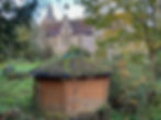
Today there are two sarsen stones propped against each other in a field in the village. I do recall seeing them some years ago as I craned my neck to see them over a wall. Sadly I can’t remember which wall and I believe it has now become overgrown. There are two possible locations from which to see the stones I believe. One was the lane that runs east-west past the front of Kingston House. The other was a driveway a little closer to and next to the church. We hoped to check both locations but the driveway was being dug up and a trench ran along its length above which a mechanical digger was working. Unable to check this location we stuck to the lane past Kingston House following the Wylye river which is little more than a stream here.
A surreptitious look in each of the gardens as we passed was fruitless. However, you will learn more from this article which includes an aerial view of the stones:
Having been thwarted so early on we continued for a short distance along the lane to a footpath which leads to the churchyard. The path is not signed and it looks like you are entering someone’s garden but rest assured the footpath is through the little iron gate close by the house on the corner of the lane.

This footpath takes you away from the lane and its pretty view of the infant Wylye. You'll know you're on the right path if you see the alpacas!

The lane itself takes you straight to the next stage of the walk but is narrow and, in the short time we were on it, we had to squeeze onto the bank of the river to allow vehicles to pass. The footpath into the churchyard is the safer option and of course provides an opportunity to visit the church – the Church of St Mary the Virgin.

The last time I tried to visit the church was on another Hidden Wiltshire walk. It was just after the 2020 lockdown and I found the church locked for safety reasons. Three years further on and the church was still locked – this time by a large and ugly padlock. Anyone who has read any of my other blogs about Wiltshire churches (there have been a few) will know how I feel about this! Locking a church is hardly a Christian act. But I guess now the reason is the risk of theft. A sad indictment of our society. I believe there is further information in the church about Egbert’s Stone but since I’ve never managed to gain access I cannot confirm that.

From the church we joined the lane at the front that heads due west along the valley towards the gliding club on the ridge of Court Hill, where Egbert’s Stone was said to have resided. At this point the rain descended on what was forecast to be a glorious sunny day. At the gate on the lane to the gliding club we took the path across the field to our right, this being the Mid Wilts Way on which we were to continue for some distance. There is no clear path but the right of way ascends diagonally across several fields towards the ridge line. The recent prolonged period of heavy rain meant the ground was boggy and the cows that often graze these fields had left deep divots and cow pats which made the going very heavy. However, where possible lift your eyes to the views that open up around you - looking back towards the village and along the length of the Wylye Valley, to the north and the brooding bulk of Cold Kitchen Hill, to the south to King’s Hill and west towards Little Knoll, Long Knoll and distant Alfred’s Tower the views everywhere are far reaching.

But also look a little closer and you will see bowl barrows everywhere. There is one burial mound by the church as we leave the village, there are two on the valley floor below close to the source of the Wylye, and another right by the path just before Court Hill Plantation. This was a theme that was to be continued throughout the day. There are numerous burial mounds in this area dating from the Neolithic onwards. This gives you a sense of what was important to our ancestors when burying their dead. The significance of places that are prominent, albeit not exclusively at height.


As we levelled out on the ridge-top the Mid Wilts Way runs parallel to the glider airfield on the other side of a fence. On a fine day up here you will hear the constant whirring of the catapult that fires the gliders into the sky. I have spent many a happy hour in the summer on Cold Kitchen Hill watching the gliders circling overhead. At the end of the fence line it is necessary to take a 90 degree left turn through a gate that leads you across the end of the airfield. On this day the ground around the gate was an absolute quagmire – wellies would have been a better choice of footwear. Soon we came to a sign warning us of the presence of the airfield.

When facing the sign behind us was a gate leading into a huge field. There was a small group of very large Aberdeen cows around the gate. But they were very placid and lazily shuffled aside to let us through, eyeing us with little more than curiosity. As we passed through the gate we struck half left across the field towards Rodmead Hill, ignoring the route to Rodmead Farm ahead. Meanwhile the cows just carried on with their grazing. All around us as we crossed Rodmead Hill are dotted tumuli and earthworks, all the while the Mid Wilts Way swinging more towards the south. These heights must have been home to many more people than it is now, the map showing ancient monuments everywhere.
After a long trudge across the fields we kept to the higher ground by the fence to our left where the grass was short and going was a little easier, we reached a field gate onto the wide track that is the Harrow Way. Diagonally to the right were the earthworks for the reservoir on White Sheet Hill which were visible for a considerable amount of time as we approached.

This was the perfect place to stop for a coffee in what was now warm sunshine with a gentle breeze. On the other side of the Harrow Way can be seen the banked ditch that forms one of the surviving sections of cross dyke. These linear earthworks are believed to have been prehistoric land boundaries and can be seen in several places on this walk. The low sun cast shadows that made them stand out a little more in the photograph.

Standing on top of the burial mound across the field containing the cross dyke provides the perfect vantage point to look across to Mere and its castle and the hill on which Shaftesbury sits a little further away. The dramatic light illuminated Dorset and Somerset in the distance.

We returned to the Harrow Way and commenced our journey east along it. If daylight hours had been longer we would probably have visited the remarkable White Sheet Hill a short distance away to the west but we knew we already risked running out of daylight before the end of the walk.
The Harrow Way vies for the accolade of being the oldest road in the country. From its beginning (or end) on the Kent coast it wends its way across southern England to the mouth of the River Axe in Devon. In several places this important road has been subsumed by the horrors of the A303. The Romans also used sections of it. In more recent times it was a coaching road and on the section we walked we found three milestones marking the distances to Old Sarum and London.

This must have been a wild and remote road in the days of the stagecoach but the heights meant that ground was less boggy and there were presumably few places in which highwaymen could hide so it was the safer option. As we walked along it I could picture the coach and horses ploughing their way along the rutted track, which in places look as though they have changed little in the last 275 years. On a winter’s day this would have been (as it is now) a rugged and exposed place.

Crossing Mere Down and the B3095 Deverills to Mere Road, we continued on the Harrow Way. There are two beautiful and remote houses on the junction of the road and its ancient predecessor.

The metalled surface on which we had been walking gave way to a more rutted and boggy surface.

We soon came to a curious line of stunted trees where we decided to stop for lunch. This turned out to be a long straight avenue of trees to the small farmhouse at Mere Down Farm which could be glimpsed illuminated by the sun at the end of the dark tunnel formed by the trees. I assume the gate on which we now leaned to eat our lunch, and which led to the farmhouse, was once the main entrance leading as it does to the Harrow Way. The main entrance now is from the modern road. The front of the house has now become the back! The house seems somewhat unassuming these days as the avenue of trees more befits a substantial country house. I’d love to know the story behind it.

We continued our journey along the Harrow Way passing more earthworks and crossing Charnage Down inexorably towards the dreaded A303, which at this point seemed a long way off.


Thankfully we were to divert from the Harrow Way just 100m short of the A303 which was built on this ancient road just west of Old Willoughby Hedge. At the edge of the large open field on the left of the track is a fence line. There are two rights of way just after this fence line that head northwards across the field but there is no evidence of these on the ground nor is there a signpost. One, a byway, heads due north and meets the aforementioned fence line on the far side of the field. The other, a bridleway, heads north-east towards the south-eastern end of an area of Open Access land that heads north-west along a dry valley. This is what Jill Caudle termed the “Splendid Bottom”!

I have to confess that I made a mistake when I plotted this walk which meant that Stu and I followed the fence line along the byway. This eventually joins the Splendid Bottom on its southern flanks. When we got to this point I realised my mistake. Looking into the Splendid Bottom from above I was devasted. It was simply beautiful. The sound of the A303 high above to the south was now but a memory. The setting sun cast deep shadows as sheep grazed contentedly in the tranquillity of the coombe.

It was too late to retrace our steps but we descended into the bottom of the Bottom and headed south-east along it to get a flavour of what we had missed. This is one of those rare places that is Open Access and which can be reached without trespassing via both a byway and a bridleway. One day I will return and walk its entire length, albeit we only missed about 500m of it. In the accompanying route map I have shown the route we took simply because I am nervous about showing the correct route until I have tested it. But once I have done so I will amend this blog.
Turning round we headed back in a north-west direction along the Bottom to the point where it meets the byway we had been on earlier. As we wound our way round the valley bottom a fence line came into view ahead. Beyond was a wood full of autumn colour next to which lie the strip lynchets near Monkton Deverill which I visited in another of my Deverill walks and to which I have provided a link below this blog.

However, on this occasion we passed through a gate and turned north-west steeply uphill over King’s Hill towards Kingston Deverill. At the top of the hill there is a T-junction where the footpath along the field boundary which we had been following meets a bridleway. Below Kingston Deverill was bathed in late afternoon sunlight, with deep shadows sculpting the landscape. We spent some time here simply absorbing the view, Cold Kitchen Hill looking even more intimidating looming over the village.


Eventually we turned right towards the nearby wood in the south-western tip of which is a wooden pedestrian gate giving access to a path that descends through the wood to the road that runs along the valley connecting the six Deverills.


Turning left on the road almost immediately on the other side is a stile giving access to a footpath across the little field, which was being grazed by a flock of small black sheep. On the other side is a lane leading through the ford where Alfred rallied his troops all those centuries ago. A footbridge crosses the ford so there is no danger of wet feet. The lane continues on and round back into the village and my car sitting in the half light in the layby where I had left it seven hours earlier.

In all this walk is approximately 14.5kms/9 miles. Apart from a couple of fairly short climbs and the descent through the wood at the end, it is mostly level although in wet weather it can be a little boggy and heavy going. There are fields which may be occupied by livestock so dogs should be kept on a lead if you must bring one. But this walk is all about the views and, as ever, about a history stretching back thousands of years. It deserves to be walked on a long warm sunny day, although I think it would be wonderful to experience the Harrow Way in the depths of winter. But then I like bleak!
